| Raposo Tavares | |
|---|---|
 | |
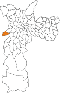
 The location of Raposo Tavares district in São Paulo The location of Raposo Tavares district in São Paulo | |
| Country | Brazil |
| State | São Paulo |
| City | São Paulo |
| Government | |
| • Type | Subprefecture |
| • Subprefect | Daniel Barbosa Rodrigueiro |
| Area | |
| • Total | 12.6 km (4.9 sq mi) |
| Population | |
| • Total | 91.204 |
| • Density | 7.238/km (18.75/sq mi) |
| HDI | 0.819 –high |
| Website | Subprefecture of Butantã |
Raposo Tavares is a district in the city of São Paulo, Brazil.
The district of Raposo Tavares belongs to the Sub-prefecture of Butantã, and is crossed by the highway with the same name. It borders the districts of Rio Pequeno and Vila Sônia. The district is undergoing rapid real estate expansion.
References
- "Raposo Tavares - Guia do bairro Raposo Tavares -SP Aqui você Encontra !". www.encontraraposotavares.com.br (in Brazilian Portuguese). Retrieved 2024-09-30.
External links
 Media related to Raposo Tavares (district of São Paulo) at Wikimedia Commons
23°35′29.972″S 46°46′52.914″W / 23.59165889°S 46.78136500°W / -23.59165889; -46.78136500
This geographical article relating to the state of São Paulo is a stub. You can help Misplaced Pages by expanding it. |
