| This article includes a list of references, related reading, or external links, but its sources remain unclear because it lacks inline citations. Please help improve this article by introducing more precise citations. (May 2024) (Learn how and when to remove this message) |
| Republic of New GranadaRepública de la Nueva Granada (Spanish) | |||||||||
|---|---|---|---|---|---|---|---|---|---|
| 1831–1858 | |||||||||
 Flag
Flag
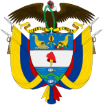
 Coat of arms
| |||||||||
| Motto: Libertad y Orden (English: Liberty and Order) | |||||||||
 Republic of New Granada Republic of New Granada | |||||||||
| Capital | Santa Fé de Bogotá | ||||||||
| Religion | Roman Catholicism | ||||||||
| Demonym(s) |
| ||||||||
| Government | Unitary presidential republic | ||||||||
| President | |||||||||
| • 1831 | Domingo Caycedo | ||||||||
| • 1857–1858 | Mariano Ospina Rodríguez | ||||||||
| History | |||||||||
| • Established | 20 October 1831 | ||||||||
| • Bill of rights | 1853 | ||||||||
| • Constitutional Change | 11 April 1858 | ||||||||
| Area | |||||||||
| • Total | 1,331,250 km (514,000 sq mi) | ||||||||
| Population | |||||||||
| • 1851 | 2,243,730 | ||||||||
| Currency | Peso | ||||||||
| |||||||||
| Abolition of slavery, and suffrage to all males over 21. | |||||||||
| Part of a series on the | ||||||||||||||||||||
|---|---|---|---|---|---|---|---|---|---|---|---|---|---|---|---|---|---|---|---|---|
| History of Colombia | ||||||||||||||||||||
 | ||||||||||||||||||||
| Timeline | ||||||||||||||||||||
|
||||||||||||||||||||
|
| ||||||||||||||||||||
The Republic of New Granada was a centralist unitary republic consisting primarily of present-day Colombia and Panama with smaller portions of today's Costa Rica, Ecuador, Venezuela, Peru and Brazil that existed from 1831 to 1858. The state was created after the dissolution of Great Colombia in 1830 through the secession of Ecuador and Venezuela. In 1858 the state was renamed into the Granadine Confederation. On 9 May 1834, the national flag was adopted and was used until 26 November 1861, with the Gran Colombian colours in Veles' arrangement. The merchant ensign had the eight-pointed star in white.
History
The history of the Republic of New Granada was marked by competing economic and political interests and rocked by violent conflicts and civil wars. One of the prime features of the political climate of the Republic was the position of the Roman Catholic Church and the level of autonomy for the federal states.
In 1839, a dispute arose over the dissolution of monasteries by the Congress of New Granada. This soon escalated into the War of the Supremes, which raged for the next two years and transformed into a conflict about regional autonomy and a border conflict with Ecuador. Panama tried unsuccessfully to break away from New Granada in 1840 and 1850.
In 1851 a Civil war took place, which was triggered by the Liberal reforms of President José Hilario López, which provided for the emancipation of slaves, the expulsion of the Jesuits, the granting of freedom of the press and the abolition of the death penalty. As a reaction, Conservative and pro-slavery groups from Cauca and Antioquia departments, led by Julio Arboleda, Manuel Ibánez and Eusebio Borrero, revolted against liberal president José Hilario López, in an attempt to prevent emancipation of disenfranchised groups and abolition of slavery, in addition to a number of religious issues.
In 1853 there was a Liberal constitutional reform, and in 1854 there was another civil war under the dictatorship of General José María Melo. In 1858 a federal constitution was introduced. An uprising by General Tomás Cipriano de Mosquera sparked a new three-year civil war in 1860. After the capture of Bogotá in 1861 by Mosquera, who proclaimed himself president, the country was renamed and given a new constitution to form the Granadine Confederation in response to demands for a decentralized administration for the country.
Provinces
Main article: Provinces of the Republic of New GranadaThe territory of the republic was divided into provinces. Each province was composed of one or more cantons, each canton was divided into several districts.
The Republic also included some territories in the peripheral regions of the country.
See also
Sources
- INSTITUCION EDUCATIVA MUNICIPAL MARCO FIDEL SUAREZ
- UNAM
- Histoire de la Colombie de 1831 à 1861
- Ecured
4°39′N 74°3′W / 4.650°N 74.050°W / 4.650; -74.050
Categories: