| This article includes a list of general references, but it lacks sufficient corresponding inline citations. Please help to improve this article by introducing more precise citations. (September 2019) (Learn how and when to remove this message) |
| Rigside | |
|---|---|
 Beechgrove Street, Rigside Beechgrove Street, Rigside | |
 | |
| Area | 0.24 km (0.093 sq mi) |
| Population | 620 (2022) |
| • Density | 2,583/km (6,690/sq mi) |
| OS grid reference | NS879351 |
| • Edinburgh | 34 mi (55 km) NE |
| • London | 320 mi (510 km) SE |
| Civil parish |
|
| Community council |
|
| Council area | |
| Lieutenancy area | |
| Country | Scotland |
| Sovereign state | United Kingdom |
| Post town | LANARK |
| Postcode district | ML11 |
| Dialling code | 01555 |
| Police | Scotland |
| Fire | Scottish |
| Ambulance | Scottish |
| UK Parliament | |
| Scottish Parliament | |
| 55°35′50″N 3°46′49″W / 55.59722°N 3.78028°W / 55.59722; -3.78028 | |
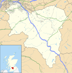
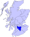
Rigside is a small village in South Lanarkshire, Scotland, about 5 miles (8 kilometres) from the town of Lanark, and less than 1 mi (1.6 km) from Douglas Water. It lies on the A70 road to Ayr, and has approximately 800 inhabitants.
Rigside is a former mining village. The village has one shop, a takeaway cafe, a public house, and a doctor's surgery. The village has very limited public transport links so most of the villagers have access to a car. The village has a nursery and primary school, both located on Muirfoot Road next to the recently upgraded play park and skate park.
The houses in the village are heated in order by ASHP, coal, oil, and LPG. There is no mains gas in the village.
There is a mixture of both private and council owned houses which are being upgraded to ASHP from solid fuel.
Climate
Drumalbin is a Met Office weather station near Rigside, situated at an elevation of 245 m.
| Climate data for Drumalbin, Elevation: 245 m (804 ft), 1991–2020 normals | |||||||||||||
|---|---|---|---|---|---|---|---|---|---|---|---|---|---|
| Month | Jan | Feb | Mar | Apr | May | Jun | Jul | Aug | Sep | Oct | Nov | Dec | Year |
| Mean daily maximum °C (°F) | 5.4 (41.7) |
5.9 (42.6) |
7.9 (46.2) |
10.8 (51.4) |
14.0 (57.2) |
16.3 (61.3) |
18.0 (64.4) |
17.7 (63.9) |
15.3 (59.5) |
11.6 (52.9) |
8.0 (46.4) |
5.7 (42.3) |
11.4 (52.5) |
| Daily mean °C (°F) | 2.9 (37.2) |
3.2 (37.8) |
4.7 (40.5) |
6.9 (44.4) |
9.7 (49.5) |
12.3 (54.1) |
14.0 (57.2) |
13.9 (57.0) |
11.8 (53.2) |
8.5 (47.3) |
5.4 (41.7) |
3.1 (37.6) |
8.1 (46.6) |
| Mean daily minimum °C (°F) | 0.5 (32.9) |
0.4 (32.7) |
1.5 (34.7) |
3.1 (37.6) |
5.4 (41.7) |
8.3 (46.9) |
10.1 (50.2) |
10.0 (50.0) |
8.3 (46.9) |
5.5 (41.9) |
2.7 (36.9) |
0.6 (33.1) |
4.7 (40.5) |
| Average precipitation mm (inches) | 93.9 (3.70) |
77.3 (3.04) |
65.6 (2.58) |
49.8 (1.96) |
53.7 (2.11) |
65.1 (2.56) |
79.0 (3.11) |
82.0 (3.23) |
68.5 (2.70) |
99.1 (3.90) |
95.3 (3.75) |
100.8 (3.97) |
930.2 (36.62) |
| Average precipitation days (≥ 1.0 mm) | 15.8 | 13.7 | 12.6 | 11.5 | 11.6 | 12.1 | 13.6 | 13.8 | 11.8 | 14.9 | 15.6 | 15.6 | 162.7 |
| Source: Met Office | |||||||||||||
References
- "Mid-2012 Population Estimates for Settlements and Localities in Scotland". National Records of Scotland. 31 July 2014. Retrieved 3 July 2022.
- "Mid-2020 Population Estimates for Settlements and Localities in Scotland". National Records of Scotland. 31 March 2022. Retrieved 31 March 2022.
- "Drumalbin Climate". Met Office. Retrieved 25 April 2024.
External links
This South Lanarkshire location article is a stub. You can help Misplaced Pages by expanding it. |
