| Rosablanche | |
|---|---|
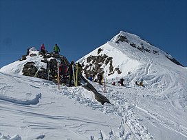
 The summit The summit | |
| Highest point | |
| Elevation | 3,336 m (10,945 ft) |
| Prominence | 227 m (745 ft) |
| Parent peak | La Ruinette |
| Coordinates | 46°03′36″N 7°21′15″E / 46.06000°N 7.35417°E / 46.06000; 7.35417 |
| Geography | |
 | |
| Location | Valais, Switzerland |
| Parent range | Pennine Alps |
The Rosablanche is a mountain of the Swiss Pennine Alps, overlooking the Lac des Dix in the canton of Valais. It lies on the range between the valleys of Bagnes (west) and Hérémence (east), north of Le Pleureur.
Climbing routes
| This section does not cite any sources. Please help improve this section by adding citations to reliable sources. Unsourced material may be challenged and removed. (May 2023) (Learn how and when to remove this message) |
The normal routes from the north side are from Barage de la Grande Dixence (Dix lake) in Val d’ Heremence, and from Siviez in Val de Nendaz, with the car access in both cases. From the Siviez side there is bus service as well. These are non-technical but very attractive glacier routes. There are also more technical portions.
The route from the south starts in the Fionnay valley (Val de Bagnes) and it is snow-free in summer time.
The huts
| This section does not cite any sources. Please help improve this section by adding citations to reliable sources. Unsourced material may be challenged and removed. (May 2023) (Learn how and when to remove this message) |
There are several huts that climbers use as start points. From the Fionnay side there is Cabane de Louvie in Val de Bagnes. From the north-east side there is Cabane de Prafleuri at 2624 m above the sea level, Cabane de Ecoulaies at 2575 m, and Ref. de la Barmaz at 2458 m. From the Siviez side there is Ref. de St. Laurent at 2485 m.
References
- Retrieved from the Swisstopo topographic maps. The key col is the Col de Sovereu (3,109 m).