| Saba National Marine Park | |
|---|---|
| IUCN category II (national park) | |
 
| |
| Location | Saba, Leeward Islands, Caribbean Sea |
| Coordinates | 17°38′06″N 63°15′00″W / 17.635°N 63.2499°W / 17.635; -63.2499 |
| Area | 5 sq mi (13 km) |
| Established | 1987 |
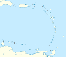
The Saba National Marine Park encompasses the waters and sea bed encircling the Caribbean island of Saba, Caribbean Netherlands, from the high water mark to 200 feet (61 m) deep. In total, the marine park covers approximately 5 square miles (13 km). At the time of its creation in 1987, the government passed the Marine Environment Ordinance to protect the coral reefs and other marine life within the park. The Saba Conservation Foundation manages the Saba National Marine Park, as well as the island's hyperbaric facility, and natural sites on land (e.g., the Saba Trail network).
Protection
A number of regulations ensure that the park's thriving aquatic life remains healthy. Zones divide the area according to acceptable uses. Commercial fishing is forbidden in certain places to prevent overfishing. The reefs are protected from damage by 36 permanently anchored buoys where boats can moor. Scuba divers are not permitted to dive by themselves; they must dive with guides from one of Saba's dive shops.
Protecting the Saba National Marine Park is not only an environmental consideration, it is also an economic concern. Tourism currently brings in more money to the island than any other industry, and the Saba National Marine Park is the biggest tourist draw.
Geography
In addition to the fact that Saba's reefs are still flourishing, unlike many others in the region, several unusual natural formations attract divers. Some of these features were formed through volcanic activity, such as the Pinnacles: these peaks rise up to 100 feet (30 m) from the ocean floor, and are covered with corals, sponges, and other invertebrate animals. In the Ladder Bay area, a natural labyrinth was created by flowing lava. Other attractions include underwater caves, tunnels, and rock walls.
Fauna

Many different species of life inhabit Saba National Marine Park, includes varieties of coral, fish, and other marine life.
Soft corals are located throughout the marine park, on all sides of the island. Hard corals live mostly in the waters on the island's east side. Porites coral, Star coral (Astreopora),Brain coral, and Gorgonian (Alcyonacea) coral can be at and around the Ladder Bay area.
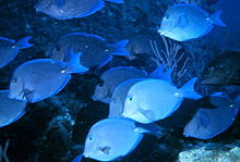
Types of fish found in the park include parrotfish, Atlantic blue tang, black durgon, and barracuda. Other fish varieties around the park include Burrfish, Chromis, Filefish, Glassy Sweepers, Goatfish, Horse-eye Jacks, Lancer Dragonets, Lizardfish, Peacock Flounders, Pikeblennies, Schoolmasters, Spotted Drums, Tarpons, Yellowfin Groupers, and Yellowhead Jawfish.

Other marine life in the marine park include octopuses, sea turtles, and spiny lobsters. Stingrays and sharks (specifically nurse sharks and reef sharks) frequent certain areas. On the west side of the island, Channel Clinging Crabs, Green Turtles, Hawksbill Turtles, Spotted Moray Eels, Squat Lobster, and Tigertail Sea Cucumber can be seen.
Visiting
Saba's residents may access the park without charge. Visitors pay $3 (US) per dive (in addition to dive shop diving fees). The park fee supports maintenance of the park and its equipment.
See also
References
- "Saba National Marine Park". protectedplanet.net.
- ^ "Saba Marine Park". www.sabapark.org. Saba Conservation Foundation. Retrieved 2024-01-28.
- "SABA MARINE ENVIRONMENT ORDINANCE: AB 1987, No. 10" (PDF). THE ISLAND COUNCIL OF THE ISLAND TERRITORY OF SABA. June 25, 1987.
- "STATUS OF PROTECTED AREA SYSTEMS IN THE WIDER CARIBBEAN REGION" (PDF). www.unep.org (CEP Technical Report: 36 ed.). United Nations Environment Programme and Caribbean Environment Programme. 1996.
- ^ "Saba Conservation Foundation - Preserving Saba's natural and cultural heritage". www.sabapark.org. Retrieved 2024-01-28.
- "Elevating the Standard of Care". Divers Alert Network. Retrieved 2024-01-28.
- "Fort Bay Harbor: Facilities". fort-bay-saba. Retrieved 2024-01-28.
- "Learn about Saba's Nature". Saba News. 2015-09-24. Retrieved 2024-01-28.
- ^ "The Protocol on Specially Protected Areas and Wildlife in the Wider Caribbean (SPAW): Saba National Marine Park" (PDF). www.car-spaw-rac.org. Regional Activity Center for the protocol relating to Specially Protected Areas and wildlife in the Greater Caribbean Region.
- "Saba Marine Park: Zoning System". sabapark.org. Saba Conservation Foundation. Retrieved 2024-01-28.
- "Mooring Buoy Planning Guide - Coral Reef Information System" (PDF). NOAA Coral Reef Information System. International PADI.
- ^ "Diving". Saba Tourism. 2018-06-22. Retrieved 2024-01-28.
- "The tourism value of nature on Saba (PDF)" (PDF). www.dcbd.nl. Caribbean Netherlands: TEEB.
- "Saba Marine Park". Sea Saba Dive Center. Retrieved 2024-01-28.
- Barone, Jeanine (2019-10-22). "A rare Caribbean island where beaches aren't the draw". CNN. Retrieved 2024-01-28.
- "Saba and Statia: Mighty Mounts of the Lesser Antilles". Dive Training Magazine | Scuba Diving Skills, Gear, Education. Retrieved 2024-01-28.
- ^ "Saba's Sea Creatures: Best Dive Sites To Encounter Marine Life". Just Gotta Dive (JGD). Retrieved 2024-01-20.
- ^ "Saba Conservation Foundation: Diving in the Marine Park". www.sabapark.org. Saba Conservation Foundation. Retrieved 2024-01-20.
- ^ "Saba's Best Dive Sites: Porites Point (AKA Lou's Ladde)". seasaba. Retrieved 2024-01-22.
- ^ "Saba's Best Dive Sites: Babylon". seasaba. Retrieved 2024-01-22.
- ^ "Saba's Best Dive Sites: Ladder Labyrinth". seasaba. Retrieved 2024-01-22.
- ^ "Saba's Best Dive Sites: 50/50". seasaba. Retrieved 2024-01-22.
External links
| Saba (island) | |||
|---|---|---|---|
| Populated places | |||
| Other locations | |||
| Transport | |||
| Education | |||
| Heraldry | |||
| Culture | |||