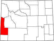
Ghost town in Wyoming, United States
| Sage, Wyoming | |
|---|---|
| Ghost town | |
  | |
| Coordinates: 41°48′49″N 110°57′30″W / 41.8135549°N 110.9582432°W / 41.8135549; -110.9582432 | |
| Country | United States |
| State | Wyoming |
| County | Lincoln |
| Elevation | 6,332 ft (1,930 m) |
Sage is a ghost town in the far southwestern part of Lincoln County, Wyoming, United States. US Route 30 is the major road, which leads north 19 miles (31 km) to Cokeville and east 25 miles (40 km) to Kemmerer. Wyoming Highway 89 runs west 4 miles (6.4 km) to the Utah border, then another 5 miles (8.0 km) to Sage Creek Junction, Utah. The Union Pacific Railroad passes Sage in the direction of Rock Springs to the east and Pocatello, Idaho, to the west.
Sage lies at 6,332 feet (1,930 m) elevation, just west over the Sublette Mountains ridge from Fossil Butte National Monument in the Sage Creek valley.
The Overland Stage Route ran north through Sage from Fort Bridger.
Climate
| Climate data for Sage, Wyoming, 1991–2020 normals, 1923-2020 extremes: 6210ft (1893m) | |||||||||||||
|---|---|---|---|---|---|---|---|---|---|---|---|---|---|
| Month | Jan | Feb | Mar | Apr | May | Jun | Jul | Aug | Sep | Oct | Nov | Dec | Year |
| Record high °F (°C) | 55 (13) |
57 (14) |
70 (21) |
80 (27) |
86 (30) |
96 (36) |
104 (40) |
103 (39) |
92 (33) |
84 (29) |
74 (23) |
61 (16) |
104 (40) |
| Mean maximum °F (°C) | 41.7 (5.4) |
45.5 (7.5) |
59.5 (15.3) |
73.0 (22.8) |
79.7 (26.5) |
85.7 (29.8) |
90.6 (32.6) |
89.8 (32.1) |
84.8 (29.3) |
78.2 (25.7) |
59.1 (15.1) |
45.2 (7.3) |
91.5 (33.1) |
| Mean daily maximum °F (°C) | 25.9 (−3.4) |
29.9 (−1.2) |
43.1 (6.2) |
55.8 (13.2) |
66.0 (18.9) |
75.1 (23.9) |
84.8 (29.3) |
82.7 (28.2) |
73.7 (23.2) |
61.2 (16.2) |
43.2 (6.2) |
27.3 (−2.6) |
55.7 (13.2) |
| Daily mean °F (°C) | 12.0 (−11.1) |
16.0 (−8.9) |
29.4 (−1.4) |
39.9 (4.4) |
48.7 (9.3) |
56.4 (13.6) |
63.6 (17.6) |
61.3 (16.3) |
52.3 (11.3) |
41.3 (5.2) |
27.6 (−2.4) |
14.3 (−9.8) |
38.6 (3.7) |
| Mean daily minimum °F (°C) | −1.9 (−18.8) |
2.1 (−16.6) |
15.7 (−9.1) |
24.0 (−4.4) |
31.3 (−0.4) |
37.7 (3.2) |
42.4 (5.8) |
39.9 (4.4) |
30.9 (−0.6) |
21.5 (−5.8) |
12.1 (−11.1) |
1.3 (−17.1) |
21.4 (−5.9) |
| Mean minimum °F (°C) | −23.7 (−30.9) |
−23.3 (−30.7) |
−6.9 (−21.6) |
12.2 (−11.0) |
19.7 (−6.8) |
26.8 (−2.9) |
31.9 (−0.1) |
26.8 (−2.9) |
15.3 (−9.3) |
6.9 (−13.9) |
−12.0 (−24.4) |
−21.9 (−29.9) |
−28.0 (−33.3) |
| Record low °F (°C) | −51 (−46) |
−51 (−46) |
−30 (−34) |
−12 (−24) |
7 (−14) |
16 (−9) |
21 (−6) |
14 (−10) |
2 (−17) |
−10 (−23) |
−34 (−37) |
−48 (−44) |
−51 (−46) |
| Average precipitation inches (mm) | 0.53 (13) |
0.49 (12) |
0.49 (12) |
0.97 (25) |
1.32 (34) |
1.06 (27) |
0.97 (25) |
0.86 (22) |
1.14 (29) |
1.05 (27) |
0.56 (14) |
0.32 (8.1) |
9.76 (248.1) |
| Source 1: NOAA | |||||||||||||
| Source 2: XMACIS (precipitation, records & monthly max/mins) | |||||||||||||
References
- ^ U.S. Geological Survey Geographic Names Information System: Sage, Wyoming
- "Entering Wyoming - Sage, Wyoming".
- ^ Official State Highway Map of Wyoming (Map). Wyoming Department of Transportation. 2014.
- "Sage 4 NNW, Wyoming 1991-2020 Monthly Normals". Retrieved November 5, 2023.
- "xmACIS". National Oceanic and Atmospheric Administration. Retrieved November 5, 2023.
| Municipalities and communities of Lincoln County, Wyoming, United States | ||
|---|---|---|
| County seat: Kemmerer | ||
| City |  | |
| Towns | ||
| CDPs | ||
| Unincorporated communities | ||
| Footnotes | ‡This populated place also extends into Idaho | |
This article about a location in Wyoming is a stub. You can help Misplaced Pages by expanding it. |