| This article needs additional citations for verification. Please help improve this article by adding citations to reliable sources. Unsourced material may be challenged and removed. Find sources: "Saint-Sulpice, Neuchâtel" – news · newspapers · books · scholar · JSTOR (December 2009) (Learn how and when to remove this message) |
Former municipality in Neuchâtel, Switzerland
| Saint-Sulpice | |
|---|---|
| Former municipality | |
 Coat of arms Coat of arms | |
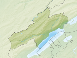
| Location of Saint-Sulpice | |
  | |
| Coordinates: 46°54′38″N 6°33′47″E / 46.91056°N 6.56306°E / 46.91056; 6.56306 | |
| Country | Switzerland |
| Canton | Neuchâtel |
| District | Val-de-Travers |
| Area | |
| • Total | 13.09 km (5.05 sq mi) |
| Elevation | 754 m (2,474 ft) |
| Population | |
| • Total | 644 |
| • Density | 49/km (130/sq mi) |
| Time zone | UTC+01:00 (Central European Time) |
| • Summer (DST) | UTC+02:00 (Central European Summer Time) |
| Postal code(s) | 2123 |
| SFOS number | 6509 |
| ISO 3166 code | CH-NE |
| Surrounded by | Boveresse, Buttes, Fleurier, La Brévine, Les Bayards |
| Website | SFSO statistics |
Saint-Sulpice was a municipality in the district of Val-de-Travers in the canton of Neuchâtel in Switzerland. On 1 January 2009, the former municipalities of Boveresse, Buttes, Couvet, Fleurier, Les Bayards, Môtiers, Noiraigue, Saint-Sulpice and Travers merged to form Val-de-Travers.
References
- Amtliches Gemeindeverzeichnis der Schweiz published by the Swiss Federal Statistical Office (in German) Retrieved 14 January 2010
This Canton of Neuchâtel location article is a stub. You can help Misplaced Pages by expanding it. |