| Saka Haphong | |
|---|---|
| Mayung Hills, Saka Haphong Tlang | |
  | |
| Highest point | |
| Elevation | 1,063 m (3,488 ft) |
| Prominence | 820 m (2,690 ft) |
| Listing | |
| Coordinates | 21°47′19″N 92°36′31″E / 21.78861°N 92.60861°E / 21.78861; 92.60861 |
| Naming | |
| Native name | |
| Geography | |
| Location | Bangladesh–Myanmar border |
| Countries | Bangladesh and Myanmar |
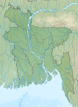
Saka Haphong (Bengali: সাকা হাফং, Burmese: ဆကးအဖောင် တောင်) is a peak in Southeast Asia and South Asia. It is located on the Bangladesh–Myanmar border and is believed to be the highest peak of Bangladesh.
See also
References
- SRTM data in agreement with 1:200,000 Soviet topographic mapping
- SRTM data in agreement with 1:200,000 Soviet topographic mapping
- Chowdhury, Masud Hasan (2012). "Physiography". In Islam, Sirajul; Jamal, Ahmed A. (eds.). Banglapedia: National Encyclopedia of Bangladesh (Second ed.). Asiatic Society of Bangladesh.
- "Bangladesh". The World Factbook. CIA.
This Chittagong Division location article is a stub. You can help Misplaced Pages by expanding it. |
This Myanmar location article is a stub. You can help Misplaced Pages by expanding it. |