| Sakhray | |
|---|---|
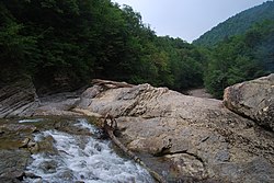
 Sakhray River Canyon Sakhray River Canyon | |
   | |
| Physical characteristics | |
| Mouth | Dakh |
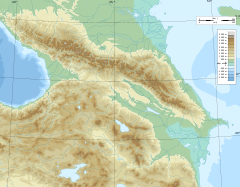
| • coordinates | 44°12′13″N 40°15′59″E / 44.2035°N 40.2664°E / 44.2035; 40.2664 |
| Length | 31 km (19 mi) |
| Basin size | 259 km (100 sq mi) |
| Basin features | |
| Progression | Dakh→ Belaya→ Kuban→ Sea of Azov |
The Sakhray (Russian: Сахрай) is a river of southwest Russia. It flows through the Republic of Adygea. It is a left tributary of the Dakh. It is 31 kilometres (19 mi) long, and has a drainage basin of 259 square kilometres (100 sq mi).
References
- "Река Сахрай (Уздычиш) in the State Water Register of Russia". textual.ru (in Russian).
This Adygea location article is a stub. You can help Misplaced Pages by expanding it. |
This article related to a river in Southern Russia is a stub. You can help Misplaced Pages by expanding it. |