| Solududhkunda सोलुदूधकुण्ड नगरपालिका | |
|---|---|
| Municipality | |
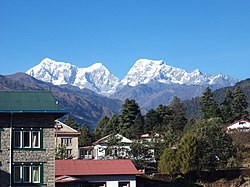
 A view from Salleri A view from Salleri | |
 | |
  | |
| Coordinates: 27°30′16″N 86°35′11″E / 27.50444°N 86.58639°E / 27.50444; 86.58639 | |
| Country | Nepal |
| Province | Koshi |
| District | Solukhumbu |
| No. of wards | 11 |
| Established | 3 December 2014 |
| Incorporated (VDC) | Salleri, Garma, Loding Tamakhani, Beni, Taksindu, Kerung, Gorakhani, Tapting, Tingla |
| Government | |
| • Type | Mayor–council |
| • Body | Solududhkunda Municipality |
| • Mayor | Namgel Jangbu Sherpa (NC) |
| • Deputy Mayor | Gandhi Maya Tamang (Nepali Congress NC) |
| • MP & Constituency | Solukhumbu 1 Manbir Rai (NCP) |
| • MLA & Constituency | Solukhumbu 1(B) Buddhi Kumar Rajbhandari (NCP) |
| Area | |
| • Total | 565.06 km (218.17 sq mi) |
| Population | |
| • Total | 24,323 |
| • Density | 43/km (110/sq mi) |
| Time zone | UTC+05:45 (NPT) |
| Website | solududhkundamun |
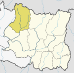
Solududhkunda (Nepali: सोलुदुधकुण्ड नगरपालिका) (earlier:Dudhkunda) is the only municipality of Solukhumbu District. Located in Koshi Province of Nepal. The town of Salleri, which is located within the municipality is the headquarter of Solukhumbu District It was formed in 2014 by merging four VDCs: Salleri, Garma, Loding Tamakhani and Beni and was divided into 9 wards. Total area of the municipality had 254.3 square kilometres (98.2 sq mi) and population of municipality had 20,399 individuals living in 5,368 households (2011 Nepal census).
In March 2017, restructuring of local level units in Nepal brought some changing in area and population. More VDCs added to the municipality: Takasindu, Kerung, Gorakhani and Tapting. After adding more VDCs to the municipality, total area of the municipality increased to 538.09 square kilometres (207.76 sq mi) and population increased to 20,399 people.
Tingla VDC was added again to this municipality on 26 February 2018 and finally the total area of this municipality became 565.06 square kilometres (218.17 sq mi) and population became 24,323 people.
Etymology
Solududhkunda is a combination of two words "Solu" and "Dudhkunda". "Solu" is a river which flows in this region and "Dudhkunda" is a lake located east of Solu river. The municipality has gain her name on river and lake which are famous in this region.
Salleri
Salleri is the main town or centre of Solududhkunda Municipality. It was a separate local level rural unit before 2014. According to the 2011 Nepal census it had total population of 6,590 individuals living in 1,682 households.
Salleri is now divided into three wards. Ward no. 4, 5 and 6 of Solududhkunda Municipality were part of Salleri Village development committee. Headquarters of Solududhkunda municipality is situated at ward no. 5.
Media
To promote local culture, Solududhkunda Municipality has two community radio stations – Radio Dudhkoshi (94.6 MHz) and Solu FM (101.2 MHz) and Himal FM.
Transportation
Most parts of Dudhkunda municipality have access to local roads. Phaplu Airport is located in Phaplu in the northern part of the municipality. After the development of Phaplu Airport, internal and foreign tourists have been using the road network for trekking to Pikey Peak and Dudh Kunda.
Climate
| Climate data for Chialsa, elevation 2,770 m (9,090 ft) | |||||||||||||
|---|---|---|---|---|---|---|---|---|---|---|---|---|---|
| Month | Jan | Feb | Mar | Apr | May | Jun | Jul | Aug | Sep | Oct | Nov | Dec | Year |
| Mean daily maximum °C (°F) | 7.4 (45.3) |
8.8 (47.8) |
13.1 (55.6) |
15.5 (59.9) |
16.4 (61.5) |
18.0 (64.4) |
18.2 (64.8) |
18.6 (65.5) |
17.5 (63.5) |
15.6 (60.1) |
11.2 (52.2) |
8.8 (47.8) |
14.1 (57.4) |
| Mean daily minimum °C (°F) | −2.4 (27.7) |
0.9 (33.6) |
2.2 (36.0) |
6.0 (42.8) |
7.8 (46.0) |
10.5 (50.9) |
11.0 (51.8) |
10.9 (51.6) |
9.9 (49.8) |
6.5 (43.7) |
1.1 (34.0) |
−1.6 (29.1) |
5.2 (41.4) |
| Average precipitation mm (inches) | 9.2 (0.36) |
11.4 (0.45) |
24.2 (0.95) |
43.8 (1.72) |
98.7 (3.89) |
290.9 (11.45) |
510.6 (20.10) |
482.6 (19.00) |
266.9 (10.51) |
76.2 (3.00) |
9.4 (0.37) |
7.7 (0.30) |
1,831.6 (72.1) |
| Source 1: Australian National University | |||||||||||||
| Source 2: Japan International Cooperation Agency (precipitation) | |||||||||||||
References
- "Districts of Nepal – Statoids".
- "Government announced 61 municipalities". www.kathmandupost.ekantipur.com. 2 December 2014. Retrieved 17 July 2018.
- "Nepal Census 2001". Nepal's Village Development Committees. Digital Himalaya. Retrieved 14 November 2008.
- ^ "Official website of Solududhkunda". www.solududhkundamun.gov.np. Retrieved 21 October 2018.
- "New local level structure comes into effect from today". www.thehimalayantimes.com. The Himalayan Times. 10 March 2017. Retrieved 17 July 2018.
- "Tingla to be merged with Solududhkunda". The Himalayan Times. 27 January 2018. Retrieved 21 October 2018.
- "VDC level report of Solukhumbu" (PDF). cbs.gov.np. Retrieved 24 October 2018.
- "FM Radio Details of Nepal". www.nepal.fm. 26 March 2013. Retrieved 21 October 2018.
- "Radio Solu". www.radiosolu.org. Retrieved 21 October 2018.
- Breeze, Adventure. "Pikey Peak Trek: Easiest way to see Everest | Cost | Itinerary for 2024, 2025". Pikey Peak.
- "CLIMATES OF NEPAL AND THEIR IMPLICATIONS FOR AGRICULTURAL DEVELOPMENT" (PDF). Australian National University. Archived from the original (PDF) on 23 October 2023. Retrieved 6 June 2024.
- "ネパール国 全国貯水式水力発電所マスタープラン調査 ファイナルレポート" (PDF). Japan International Cooperation Agency. Archived from the original (PDF) on 6 April 2024. Retrieved 6 June 2024.
External links
- Official website of Solududhkunda municipality
- District Corrected Last for RAJAPATRA
- Details of the local level bodies
| Solukhumbu District | ||
|---|---|---|
| Headquarter: Salleri | ||
| Municipality |  | |
| Rural Municipalities | ||
| Municipalities of Koshi Province | |
|---|---|
| Metropolitan cities | |
| Sub-metropolitan cities | |
| Largest municipalities (by population) | |
| Largest Rural municipalities (by population) | |
This article about a location in Solukhumbu District, Nepal is a stub. You can help Misplaced Pages by expanding it. |