| Sambo Creek | |
|---|---|
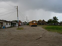
 Sambo Creek - coast with residential houses (2005) Sambo Creek - coast with residential houses (2005) | |
 | |
| Coordinates: 15°47′30″N 86°37′51″W / 15.79167°N 86.63083°W / 15.79167; -86.63083 | |
| Country | |
| Department | Atlántida |
| Population | |
| • Total | 3,436 |
| Time zone | UTC-6 (Central America) |
Sambo Creek is a traditional Garífuna village 15 kilometres (9 mi) east of La Ceiba on the Caribbean Sea north coast of Honduras.
Culture
Sambo Creek has one of the largest Garifuna population in Honduras and is considered to be one of the epicenters of cultural preservation. An annual fair in June is held there and traditional dances are still practiced, like the punta.
Demographics
The ethnic composition is 65% Garifuna, 35% Mestizo.
Notable people
- Rolando Palacios, Honduran Olympic Sprinter.
- Milton Núñez, Honduran footballer.
References
- Citypopulation.de Population of the localities in La Ceiba Municipality.
- "SAMBO CREEK Geography Population Map cities coordinates location - Tageo.com". www.tageo.com. Retrieved 2021-07-03.
| This article needs additional citations for verification. Please help improve this article by adding citations to reliable sources. Unsourced material may be challenged and removed. Find sources: "Sambo Creek" – news · newspapers · books · scholar · JSTOR (January 2021) (Learn how and when to remove this message) |
15°47′30″N 86°37′51″W / 15.79167°N 86.63083°W / 15.79167; -86.63083
This Honduras location article is a stub. You can help Misplaced Pages by expanding it. |