| San Luis Río Colorado Airport Aeropuerto de San Luis Río Colorado | |||||||||||
|---|---|---|---|---|---|---|---|---|---|---|---|
 | |||||||||||
| Summary | |||||||||||
| Airport type | Public | ||||||||||
| Serves | San Luis Río Colorado, Sonora, Mexico | ||||||||||
| Time zone | MST (UTC-07:00) | ||||||||||
| Elevation AMSL | 15 m / 49 ft | ||||||||||
| Coordinates | 32°26′43″N 114°47′52″W / 32.44528°N 114.79778°W / 32.44528; -114.79778 | ||||||||||
| Map | |||||||||||
  | |||||||||||
| Runways | |||||||||||
| |||||||||||
| Statistics (2020) | |||||||||||
| |||||||||||
| Source: Agencia Federal de Aviación Civil | |||||||||||
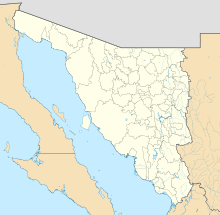
San Luis Río Colorado Airport (Spanish: Aeropuerto de San Luis Rio Colorado) (IATA: UAC, ICAO: MM76) was an airport located in San Luis Río Colorado, Sonora in Mexico, near the U.S.-Mexico border. It served general aviation purposes, featuring a runway designated 13/31, with an asphalt surface measuring 1,504 by 30 metres (4,934 ft × 98 ft). Adjacent facilities included an apron, several hangars, and a small terminal building, which was demolished in the early 2020s. A small shopping mall has been constructed on the northern edge of the airport grounds. The nearest airport providing commercial flights is Mexicali International Airport, located 48 kilometres (30 mi) west of San Luis Río Colorado.
See also
References
- ^ Airport information for from DAFIF (effective October 2006)
- Airport information for UAC at Great Circle Mapper. Source: DAFIF (effective October 2006).
- "Inaugura la "Vía Plaza" en la colonia Aeropuerto" (in Spanish).
External links
- Aeronautical chart and airport information for MM76 at SkyVector
- Current weather for MM76 at NOAA/NWS
- Accident history for UAC at Aviation Safety Network
- San Luis Río Colorado Airport information at Great Circle Mapper
- MM76 at Fallingrain.
- MM76 at Elite Jets.
- MM76 pic at Our Airports.