 Satellite photo of Oeno Island Satellite photo of Oeno Island | |
| Geography | |
|---|---|
| Location | Southern Pacific Ocean |
| Coordinates | 23°55′36″S 130°44′14″W / 23.92667°S 130.73722°W / -23.92667; -130.73722 |
| Total islands | 2–3 |
| Area | 20 km (7.7 sq mi) |
| Administration | |
| Pitcairn Islands | |
| Demographics | |
| Population | 0 ( 2001 ) |
Oeno Island (/oʊˈiːnoʊ/ oh-EE-noh) or Holiday Island is an uninhabited coral atoll in the South Pacific Ocean, part of the Pitcairn Islands overseas territory. It is part of the Pitcairn Island Group, together with Pitcairn, Henderson and Ducie islands.
Geography
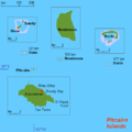
Oeno Island is located 143 kilometres (89 mi) northwest of Pitcairn Island, at 23°55′26″S 130°44′03″W / 23.92389°S 130.73417°W / -23.92389; -130.73417. Oeno Atoll measures about 5 kilometres (3.1 mi) in diameter, including the central lagoon, with a total area exceeding 20 square kilometres (7.7 sq mi). There are two larger and three smaller islets on or within the rim of the atoll. Their aggregate land area is only 0.69 square kilometres (170 acres). Oeno serves as a private holiday site for the few residents of Pitcairn Island, who travel there and stay for two weeks in January because Oeno has beaches while Pitcairn doesn't.
The main island (Oeno Island), about 50 hectares (120 acres) in area, has forest and scrub with pandanus and palm trees. It is located in the southwest part of the atoll's lagoon. There is a water tap installed on the island. The maximum elevation is less than 5 metres (16 ft). Sandy Island (or Islands) is to the northeast, within the lagoon, and may be an ephemeral island. Three smaller islets are to the south and west of the main island.
Important Bird Area
The island has been identified by BirdLife International as an Important Bird Area (IBA) principally for its colony of Murphy's petrels, which, at some 12,500 pairs, is estimated to be the second largest colony of these birds in the world.
Maps

History
- January 1819: Captain James Henderson of the British East India Company ship Hercules sights Oeno Island
- 1822–1823 Captain Ralph Bond in sealing brig Martha of London saw this island, presumably in the summer/autumn of 1822.
- 26 January 1824: Captain George Worth aboard the American whaler Oeno names the atoll after his ship
- 5 March 1858: The Wild Wave, a 1500-ton clipper ship sailing from San Francisco, is wrecked on Oeno's reef
- 1875: The Khandeish is wrecked on Oeno
- 23 August 1883: The Oregon is wrecked on Oeno
- April 1893: The Bowdon is wrecked on Oeno
- 10 July 1902: Oeno annexed by the United Kingdom
- 1938: Incorporated into the Pitcairn Islands colony
- 1997: Polynesian rats exterminated
- 2 July 2019: Oeno Island experienced a total solar eclipse
See also
References
- The name is not Polynesian but Greek. The island was named after the whaling ship Œno /ˈiːnoʊ/. However, the islanders pronounce as if each vowel letter were a syllable, as in Polynesian names.
- "Oeno Island Photo Tour". Pitcairn Islands Study Center.
-
South Pacific & Micronesia. Lonely Planet. 2006. p. 427. ISBN 978-1-74104-304-4.
Unless you've got your own yacht, your only chance of getting to Oeno is in January, when Pitcairners fit out two of their longboats with essential supplies and swap everyday life on Pitcairn for a fortnight's summer holiday on Oeno.
- "Oeno Island". Pitcairn Island Study Center. Pacific Union College. Retrieved 21 September 2019.
According to the Guide to Pitcairn ... Oeno is also a retreat for the Pitcairners, who usually make a trip during the summer to enjoy the beaches that Pitcairn does not have.
- Fresh water is pumped out of a well dug in the sand Archived 24 November 2016 at the Wayback Machine – library.puc.edu
- BirdLife International. "Oeno Island". Sites - Important Bird Areas (IBAs). Retrieved 3 November 2012.
- Dehner, Steve (2019). THE ARMCHAIR NAVIGATOR I: Supplements to Post-Spanish Discoveries in The Pacific. Bad Tattoo Inc. pp. 2–7.
- "Wreck Of The Wild Wave 1858 - Shipwrecked on Pitcairn Island's Oeno". wheresmamba. Archived from the original on 21 September 2019. Retrieved 21 September 2019.
Source - Shipmasters of Cape Cod, by Henry C. Kittredge
- "Shipwrecks". Pitcairn Islands Philatelic Bureau. Government of the Pitcairn Islands. 22 June 1994. Retrieved 21 September 2019.
The first locally recorded shipwreck was that of the Wildwave when she was outward bound from San Francisco and struck the reef of Oeno Island in March 1858.
- Silverman, David (1967). Pitcairn Island. Cleveland, Ohio: World Publishing Company. p. 125. Retrieved 11 August 2012.
- "Shipwrecks". Pitcairn Islands Philatelic Bureau. Government of the Pitcairn Islands. 22 June 1994. Retrieved 21 September 2019.
23 August 1883 ... the Pitcairners found a boat belonging to the barque Oregon bound from Oregon to Chile which had struck the reefs of Oeno.
- "Total solar eclipse hits South America". BBC News. 2 July 2019. Retrieved 3 July 2019.
External links
- Oeno Photo Tour – Pitcairners spending holidays on the island
- Island Evolution: Oeno Island from NASA Earth Observatory
- Map of Oeno Island
| Pitcairn Islands articles | |||
|---|---|---|---|
| Islands |  | ||
| Settlement | |||
| Politics | |||
| Culture |
| ||
| Other topics | |||
| Outlying territories of European countries | |
|---|---|
| Territories under European sovereignty but closer to or on continents other than Europe (see inclusion criteria for further information). | |
| Denmark | |
| France | |
| Netherlands | |
| Norway | |
| Portugal | |
| Spain | |
| United Kingdom | |

