You can help expand this article with text translated from the corresponding article in Indonesian. (February 2024) Click for important translation instructions.
|
| Sangkulirang | |
|---|---|
| District | |
 | |
  | |
| Coordinates: 0°59′16″N 117°58′48″E / 0.98778°N 117.98000°E / 0.98778; 117.98000 | |
| Country | |
| Province | East Kalimantan |
| Regency | East Kutai Regency |
| Government | |
| • Camat | Hormansyah |
| Area | |
| • Total | 2,046.8 km (790.3 sq mi) |
| Population | |
| • Total | 24,245 |
| • Density | 12/km (31/sq mi) |
| Time zone | UTC+8 (ICT) |
| Villages | 15 |
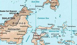
Sangkulirang is an administrative district (kecamatan) of East Kutai Regency, in East Kalimantan Province of Indonesia. The district lies in the northern part of the Makassar Strait and at the southern part of the Mangkalihat Peninsula. Sangkulirang includes the delta of the Karangan River, which forms the Sangkulirang Bay on the east coast of Borneo (Kalimantan). Most of the district is vegetated with mangrove forest and has some notable karst areas with steep limestone cliffs. It covers an area of 2,046.8 km and had a population of 16,181 at the 2010 Census and 26,449 at the 2020 Census, while the official estimate as at mid 2023 was 24,245. The district's seat is located in the town of Benua Baru on the west side of the Karangan River, at the point where it opens out into Sankulirang Bay.
Villages
Sangkulirang District is divided into the following fifteen villages (desa), listed below with their areas and their populations at the 2020 Census and according to the mid-2023 official estimates.
| Kode Wilayah |
Name | Area (km) |
Pop'n Census 2020 |
Pop'n Estimate mid 2023 |
Hamlets (dusun) |
Rukun Warga |
|---|---|---|---|---|---|---|
| 64.08.05.2001 | Kerayaan | 63.80 | 3,222 | 2,989 | 2 | 10 |
| 64.08.05.2002 | Tanjung Manis | 101.80 | 862 | 661 | 2 | 4 |
| 64.08.05.2003 | Peridan | 55.69 | 2,419 | 1,617 | 3 | 10 |
| 64.08.05.2004 | Saka | 135.71 | 708 | 719 | 2 | 5 |
| 64.08.05.2005 | Mandu Dalam | 329.18 | 1,311 | 865 | 2 | 6 |
| 64.08.05.2006 | Benua Baru Ilir | 55.11 | 5,322 | 5,595 | 5 | 26 |
| 64.08.05.2011 | Sempayau | 81.21 | 1,742 | 1,461 | 2 | 6 |
| 64.08.05.2012 | Pelawan | 112.54 | 2,426 | 1,862 | 2 | 7 |
| 64.08.05.2013 | Tepian Terap | 777.89 | 1,366 | 1,451 | 1 | 4 |
| 64.08.05.2015 | Maloy | 59.16 | 1,082 | 1,274 | 2 | 6 |
| 64.08.05.2016 | Benua Baru Ulu | 20.24 | 2,715 | 2,720 | 3 | 14 |
| 64.08.05.2017 | Kolek | 67.56 | 594 | 540 | 1 | 3 |
| 64.08.05.2018 | Pulau Miang | 26.51 | 814 | 799 | 1 | 3 |
| 64.08.05.2019 | Perupuk | 58.01 | 1,116 | 840 | 2 | 6 |
| 64.08.05.2020 | Mandu Pantai Sejahtera |
27.82 | 750 | 852 | 2 | 5 |
| Totals | Sangkulirang | 2,046.80 | 26,449 | 24,245 | 32 | 115 |
References
- ^ Kecamatan Sangkulirang Dalam Angka 2022
- "Sangkulirang". Indonesia Traveling. Retrieved December 8, 2010.
- Badan Pusat Statistik, Jakarta, 26 September 2024, Kecamatan Sangkulirang Dalam Angka 2024 (Katalog-BPS 1102001.6404050)
- Badan Pusat Statistik, Jakarta, 26 September 2024, Kecamatan Sangkulirang Dalam Angka 2024 (Katalog-BPS 1102001.6404050)
This East Kalimantan location article is a stub. You can help Misplaced Pages by expanding it. |