| Selitë | |
|---|---|
| Village | |
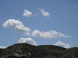
 The hills of Selitë The hills of Selitë | |
 | |
| Coordinates: 41°22′N 19°51′E / 41.367°N 19.850°E / 41.367; 19.850 | |
| Country | |
| County | Tirana |
| Municipality | Tirana |
| Municipal unit | Farkë |
| Time zone | UTC+1 (CET) |
| • Summer (DST) | UTC+2 (CEST) |
Selitë is a neighborhood of Tirana in the former municipality of Farkë in Tirana County, Albania. At the 2015 local government reform it became part of the municipality Tirana.
Selitë is divided into two parts, Big Selitë (Selita e Madhe) and Small Selitë (Selita e Vogël).
Population in municipality nr.5 ( where Selita is) is estimated to be around 80,000. Keep in mind that in the same municipality the neighbourhood of Komuna Parisit is also located.
References
- "Qarku Tirane". Shoqata e Komunave të Shqipërisë. Archived from the original on 3 September 2011. Retrieved 9 May 2011.
- "Law nr. 115/2014" (PDF) (in Albanian). p. 6375. Retrieved 25 February 2022.
| Subdivisions of Tirana municipality | ||
|---|---|---|
| Municipal seat: Tirana | ||
| Administrative unit of Baldushk |  | |
| Administrative unit of Bërzhitë | ||
| Administrative unit of Dajt | ||
| Administrative unit of Farkë | ||
| Administrative unit of Kashar | ||
| Administrative unit of Krrabë | ||
| Administrative unit of Ndroq | ||
| Administrative unit of Petrelë | ||
| Administrative unit of Pezë | ||
| Administrative unit of Shëngjergj | ||
| Administrative unit of Tirana (1–11) | ||
| Administrative unit of Vaqarr | ||
| Administrative unit of Zall-Bastar | ||
| Administrative unit of Zall-Herr | ||
| ||
This article about a specific location in Tirana County, Albania, is a stub. You can help Misplaced Pages by expanding it. |