| Semiletka Семилетка | |
|---|---|
| Selo | |
 | |
  | |
| Coordinates: 55°21′N 54°36′E / 55.350°N 54.600°E / 55.350; 54.600 | |
| Country | Russia |
| Region | Bashkortostan |
| District | Dyurtyulinsky District |
| Time zone | UTC+5:00 |
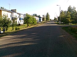
Semiletka (Russian: Семилетка) is a rural locality (a selo) and the administrative centre of Semiletovsky Selsoviet, Dyurtyulinsky District, Bashkortostan, Russia. The population was 3,977 as of 2010. There are 20 streets.
Geography
Semiletka is located 29 km southwest of Dyurtyuli (the district's administrative centre) by road. Verkhnemancharovo is the nearest rural locality.
References
- Карта Дюртюлинского района Башкортостана
- Всероссийская перепись населения 2010 года. Численность населения по населённым пунктам Республики Башкортостан
- Расстояние от Семилетки до Дюртюли
This Dyurtyulinsky District location article is a stub. You can help Misplaced Pages by expanding it. |