| Severínia | |
|---|---|
| Municipality | |
| The Municipality of Severínia | |
 Flag Flag Seal Seal | |
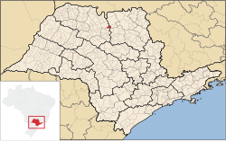
 Location of Severínia Location of Severínia | |
 | |
| Coordinates: 20°48′32″S 48°48′10″W / 20.80889°S 48.80278°W / -20.80889; -48.80278 | |
| Country | |
| Region | Southeast |
| State | |
| Area | |
| • Total | 140.4 km (54.2 sq mi) |
| Elevation | 605 m (1,985 ft) |
| Population | |
| • Total | 17,661 |
| • Density | 110.3/km (286/sq mi) |
| Time zone | UTC−3 (BRT) |
| Postal Code | 14735-000 |
| Area code | +55 17 |
| Website | Prefecture of Severínia |
Severínia is a municipality in the state of São Paulo, Brazil. The city has a population of 17,661 inhabitants and an area of 140.4 km.
Severínia belongs to the Mesoregion of São José do Rio Preto.
Media
In telecommunications, the city was served by Companhia Telefônica Brasileira until 1973, when it began to be served by Telecomunicações de São Paulo. In July 1998, this company was acquired by Telefónica, which adopted the Vivo brand in 2012.
The company is currently an operator of cell phones, fixed lines, internet (fiber optics/4G) and television (satellite and cable).
Religion
See also: Religion in Brazil, Protestantism in Brazil, and Roman Catholic Church in BrazilChristianity is present in the city as follows:
Catholic Church
The Catholic church in the municipality is part of the Roman Catholic Diocese of Barretos.
Protestant Church
The most diverse evangelical beliefs are present in the city, mainly Pentecostal, including the Assemblies of God in Brazil (the largest evangelical church in the country), Christian Congregation in Brazil, among others. These denominations are growing more and more throughout Brazil.
See also
- List of municipalities in the state of São Paulo by population
- List of municipalities in the state of São Paulo by area
References
- IBGE 2020
- "2010 Census of the IBGE - Population - Table 2.1.20" (PDF) (in Portuguese). IBGE.gov.br. Retrieved 11 June 2012.
- "Creation of Telesp - April 12, 1973". www.imprensaoficial.com.br (in Portuguese). Retrieved 2024-05-27.
- ^ "Our History - Telefônica RI". Telefônica. Retrieved 2024-05-27.
- "Sul 1 Region of Brazil [Catholic-Hierarchy]". www.catholic-hierarchy.org. Retrieved 2024-07-21.
- "Campos Eclesiásticos". CONFRADESP (in Portuguese). 2018-12-10. Retrieved 2024-07-21.
- "Arquivos: Locais". Assembleia de Deus Belém – Sede (in Portuguese). Retrieved 2024-07-21.
- "Localidade - Congregação Cristã no Brasil". congregacaocristanobrasil.org.br (in Portuguese). Retrieved 2024-07-21.
This geographical article relating to the state of São Paulo is a stub. You can help Misplaced Pages by expanding it. |