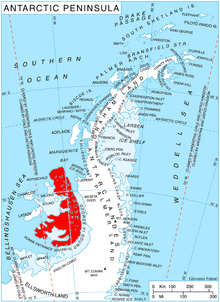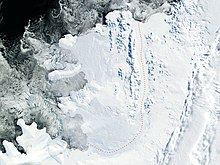

Shaw Nunatak (69°33′S 71°12′W / 69.550°S 71.200°W / -69.550; -71.200) is a nunatak rising to 500 m in Nichols Snowfield, northern Alexander Island, Antarctica. It is situated 5.3 km north-northeast of Rachenitsa Nunatak, 4.23 km east-southeast of Tipits Knoll and 7 km southeast of Mount Kliment Ohridski in Sofia University Mountains, 7.5 km southwest of Lizard Nunatak and 8.1 km northwest of Tegra Nunatak. The feature was photographed from the air by Ronne Antarctic Research Expedition in 1947–48, and mapped from these photographs by D. Searle of Falkland Islands Dependencies Survey, 1960. The nunatak was named by United Kingdom Antarctic Place-Names Committee in 1977 after Colin Shaw (1944–78), British Antarctic Survey surveyor who worked in Alexander Island, from 1975 to 1976.
See also
![]() This article incorporates public domain material from "Shaw Nunatak". Geographic Names Information System. United States Geological Survey.
This article incorporates public domain material from "Shaw Nunatak". Geographic Names Information System. United States Geological Survey. ![]()
This Alexander Island location article is a stub. You can help Misplaced Pages by expanding it. |