| This article contains promotional content. Please help improve it by removing promotional language and inappropriate external links, and by adding encyclopedic text written from a neutral point of view. (January 2025) (Learn how and when to remove this message) |
| Shell Cove Shellharbour, New South Wales | |||||||||||||||
|---|---|---|---|---|---|---|---|---|---|---|---|---|---|---|---|
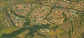
 Aerial view from the east Aerial view from the east | |||||||||||||||
 | |||||||||||||||
| Coordinates | 34°35.4′S 150°51.7′E / 34.5900°S 150.8617°E / -34.5900; 150.8617 | ||||||||||||||
| Population | 7,591 (2021 census) | ||||||||||||||
| Postcode(s) | 2529 | ||||||||||||||
| LGA(s) | City of Shellharbour | ||||||||||||||
| Region | Illawarra | ||||||||||||||
| County | Camden | ||||||||||||||
| Parish | Terragong | ||||||||||||||
| State electorate(s) | Shellharbour | ||||||||||||||
| Federal division(s) | Gilmore | ||||||||||||||
| |||||||||||||||
Shell Cove is an affluent seaside suburb in the Shellharbour area located just south of Wollongong, New South Wales, Australia. Shell Cove adjoins Bass Point and Killalea State Park and includes a variety of facilities and amenities such as: parks and bush reserves, The Links Golf Course, Shell Cove Public School & pre-schools, Shellharbour Anglican College, Family Health Medical Centre and of course the newly developed Shell Cove Harbour, The Waterfront development, and Shellharbour Marina.
Heritage listings
Shell Cove has a number of heritage-listed sites, including:
- Boollwarroo Parade: Bass Point Reserve
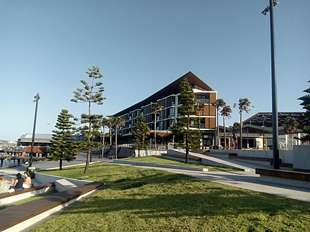
Shell Cove Harbour, Shellharbour Marina and The Waterfront, Shell Cove
Shell Cove Harbour is a remarkable 30% bigger than Darling Harbour, measuring in area more than 10 hectares. Surrounding the harbour and Shellharbour Marina are 2.6km of public paths, promenades and boardwalks. These extend out to the southern breakwater and northern breakwater along with adjoining sandy Shellharbour South Beach.
Shell Cove's new harbour, marina, harbourside town centre have been welcomed by many in the local community. Shellharbour Marina was opened in late 2021 and offers 270 berths, fuel wharf open 7 days, undercroft storage, and client amenities.
The new marina and Shell Cove Harbour are at the heart of an award winning development The Waterfront, Shell Cove which includes The Waterfront Town Centre and dining precinct. Here visitors and locals can enjoy a variety of restaurants and The Waterfront Tavern overlooking the stunning harbour and Shellharbour Marina
The Town Centre also provides multiple cafes, a barber, full line Woolworths, liquor store, artisan bakery, gelato store, vhemist, vet, bulk foods and boutique retail stores. There is also a Kids Beach that offers a nice space for parents to sit and watch their kids. There are many apartments that have a direct view into the marina.
For people who enjoy gardening, there is a Community Garden who meet on Wednesdays and Saturdays. For the thrill-seekers, BIGWAVE Skydive conducts parachute landings at Bass Point which is on the Southern side of the marina and Shell Cove Harbour.

Butterflies
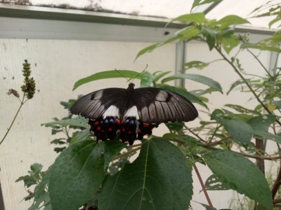
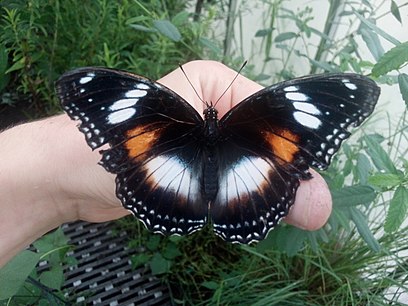
Shell Cove is home to a variety of butterfly species. The excellent ecological value of this area thanks to the significant preservation of naturally occurring habitats means that butterflies can flourish if the weather is favourable.
Here are some of the species a local butterfly expert has recorded in Shell Cove:
- The Orchard Swallowtail

- The Dainty Swallowtail
- The Blue Triangle
- The Black Jezebel

- The Cabbage White
- The Meadow Argus
- The Australian Painted Lady
- The Yellow Admiral
- The Monarch
- The Lesser Wanderer
- Grass Darts
- Ochres
- Glistening Pencil Blue
- Small Green Banded Blue
- Grass Blues
- The Plumbago Blue
And even butterflies that rarely come to Shell Cove like:
- The Varied Eggfly
- The Common Crow
- The Spotted Jezebel
- The Blue Tiger
- The Macleay's Swallowtail
References
- Australian Bureau of Statistics (28 June 2022). "Shell Cove (State Suburb)". 2021 Census QuickStats. Retrieved 30 July 2024.

- "Bass Point Reserve". New South Wales State Heritage Register. Department of Planning & Environment. H01896. Retrieved 18 May 2018.
 Text is licensed by State of New South Wales (Department of Planning and Environment) under CC BY 4.0 licence.
This Shellharbour geography article is a stub. You can help Misplaced Pages by expanding it. |