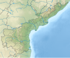
Dam in Andhra Pradesh, India
| Somasila Dam | |
|---|---|
 Aerial view of the dam in September 2018 Aerial view of the dam in September 2018 | |
 | |
| Official name | Somasila Dam |
| Location | Somasila, Nellore district, Andhra Pradesh, India |
| Coordinates | 14°29′22″N 79°18′19″E / 14.48944°N 79.30528°E / 14.48944; 79.30528 |
| Construction began | 1985 |
| Opening date | 1989 |
| Owner(s) | Government of Andhra Pradesh |
| Operator(s) | Andhra Pradesh |
| Dam and spillways | |
| Type of dam | Earth-fill & Gravity |
| Impounds | Penna River |
| Height | 39 m (128 ft) |
| Length | 760 m (2,493 ft) |
| Spillway type | Ogee type |
| Reservoir | |
| Creates | Somasila Reservoir |
| Total capacity | 75 Tmcft @ F.R.L. +100.58M |
| Catchment area | 2.20862 km (1,790,557 acre⋅ft) |
| Surface area | 212.28 km (52,456 acres) |
| Power Station | |
| Operator(s) | APGENCO |
The "Somasila Dam" is a dam constructed across the Penna River near Somasila, Nellore district, Andhra Pradesh, India. The reservoir impounded by the dam has a surface area of 212.28 km (52,456 acres) with live storage capacity of 1.994 km (1,616,562 acre⋅ft) or 75 tmcft.
The reservoir can get water by gravity from the Srisailam reservoir located in Krishna basin. It is the biggest storage reservoir in Penna River basin and can store all the inflows from its catchment area in a normal year. This reservoir can also feed by gravity nearby 72 tmcft gross storage capacity Kandaleru reservoir. Under Indian Rivers Inter-link projects, it is planned to connect the reservoir with the Nagarjunasagar reservoir to augment its water inflows.
One of the main canals is the Kavali Canal. Kavali canal is feeding to the 52 tanks under system of tanks. It will be covered dagadarthi mandal, sangham mandal, jaladanki mandal and kavali mandal. The total length of the canal is 67.619 km. Kavali Canal is the main source of drinking to Kavali municipality of nearly 1.2 lakh population.
It is nearly 79 kilometers distance from the District Head Quarters.
See also
- List of dams and reservoirs in Andhra Pradesh
- List of dams and reservoirs in India
- List of largest reservoirs in India
References
- "India: National Register of Large Dams 2009" (PDF). Central Water Commission. Archived from the original (PDF) on 21 July 2011. Retrieved 9 July 2015.
- "Somasila Dam D00750". Archived from the original on 11 September 2016. Retrieved 9 July 2015.
| Penna basin | |||||
|---|---|---|---|---|---|
| Rivers | |||||
| Dams, barrages | |||||
| Geographical features/ regions |
| ||||
| Riparian districts |
| ||||
| Canals | |||||
| Cities | |||||
| Ores and Minerals | |||||
| Industries | |||||
| Transport | |||||
| Related topics | |||||
| Other river basins | |||||