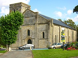
Commune in Nouvelle-Aquitaine, France
| Soulac-sur-Mer Solac de Mar (Occitan) | |
|---|---|
| Commune | |
 Notre-Dame-de-la-Fin-des-Terres Basilica,
a UNESCO world heritage site since 1998 Notre-Dame-de-la-Fin-des-Terres Basilica,
a UNESCO world heritage site since 1998 | |
 Coat of arms Coat of arms | |
| Location of Soulac-sur-Mer | |
  | |
| Coordinates: 45°30′43″N 1°07′25″W / 45.5119°N 1.1236°W / 45.5119; -1.1236 | |
| Country | France |
| Region | Nouvelle-Aquitaine |
| Department | Gironde |
| Arrondissement | Lesparre-Médoc |
| Canton | Le Nord-Médoc |
| Government | |
| • Mayor (2020–2026) | Xavier Pintat |
| Area | 28.89 km (11.15 sq mi) |
| Population | 3,011 |
| • Density | 100/km (270/sq mi) |
| Demonym(s) | Soulacais, Soulacaise (French) |
| Time zone | UTC+01:00 (CET) |
| • Summer (DST) | UTC+02:00 (CEST) |
| INSEE/Postal code | 33514 /33780 |
| Elevation | 0–25 m (0–82 ft) (avg. 12 m or 39 ft) |
| French Land Register data, which excludes lakes, ponds, glaciers > 1 km (0.386 sq mi or 247 acres) and river estuaries. | |
Soulac-sur-Mer (French pronunciation: [sulak syʁ mɛʁ]; Occitan: Solac de Mar, [suˈlak de ˈmaɾ], lit. 'Soulac on Sea'), commonly known as Soulac (Solac), is a commune in the department of Gironde, administrative region of Nouvelle-Aquitaine (formerly Aquitaine), France. It's a seaside resort on the Côte d'Argent, on the peninsula of Médoc, 12 km from Royan and 86 km from Bordeaux.
History
The history of the town remains relatively unknown before the medieval period. The town was for a time known as Noviomagus, mentioned by Ptolemy in his work Geography as being one of the two parts of a city held by the Bituriges Vivisques tribe, but this theory remains controversial in modern times. The territory of the town has been inhabited since the Neolithic period and through the Bronze Age, as shown by several archaeological discoveries. At the time, the configuration of the coasts differed. Soulac, today by the sea, was then located on the banks of the river. The town was at the end of an ancient route known as the Levade (or Lébade).
Population
|
| ||||||||||||||||||||||||||||||||||||||||||||||||||||||||||||||||||||||||||||||||||||||||||||||||||||||||||||||||||
| Source: EHESS and INSEE (1968-2017) | |||||||||||||||||||||||||||||||||||||||||||||||||||||||||||||||||||||||||||||||||||||||||||||||||||||||||||||||||||
Twin towns — sister cities
Soulac is twinned with:
 Saarburg, Germany (1972)
 Ospedaletti, Liguria, Italy (1972)
 Burgo de Osma-Ciudad de Osma, Castile and León, Spain (1988)
 Castlerea, Connacht, Ireland (1990)
See also
References
- "Répertoire national des élus: les maires". data.gouv.fr, Plateforme ouverte des données publiques françaises (in French). 2 December 2020.
- "Populations de référence 2022" (in French). The National Institute of Statistics and Economic Studies. 19 December 2024.
- Des villages de Cassini aux communes d'aujourd'hui: Commune data sheet Soulac-sur-Mer, EHESS (in French).
- Population en historique depuis 1968, INSEE
This Gironde geographical article is a stub. You can help Misplaced Pages by expanding it. |