Village in New York, United States
| South Blooming Grove, New York | |
|---|---|
| Village | |
| Village of South Blooming Grove | |
 Village hall Village hall | |
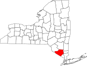
 Location in Orange County and the state of New York. Location in Orange County and the state of New York. | |
 | |
| Coordinates: 41°22′24″N 74°10′42″W / 41.37333°N 74.17833°W / 41.37333; -74.17833 | |
| Country | United States |
| State | New York |
| County | Orange County |
| Town | Blooming Grove |
| Incorporated (village) | 2006 |
| Area | |
| • Total | 4.71 sq mi (12.20 km) |
| • Land | 4.68 sq mi (12.11 km) |
| • Water | 0.03 sq mi (0.09 km) |
| Population | |
| • Total | 3,973 |
| • Density | 849.66/sq mi (328.02/km) |
| Time zone | UTC-5 (Eastern (EST)) |
| • Summer (DST) | UTC-4 (EDT) |
| FIPS code | 36-68610 |
| GNIS feature ID | 2391145 |
| Website | www |
South Blooming Grove is a village inside the Town of Blooming Grove in Orange County, New York, United States. As of the 2020 census the population was 3,973. It is part of the Kiryas Joel–Poughkeepsie–Newburgh, NY Metropolitan Statistical Area as well as the larger New York–Newark–Bridgeport, NY-NJ-CT-PA Combined Statistical Area.
History
| This section does not cite any sources. Please help improve this section by adding citations to reliable sources. Unsourced material may be challenged and removed. (June 2017) (Learn how and when to remove this message) |
The idea for incorporating a new village came in 2004 when a group called the South Blooming Grove Homeowner's Association was concerned about the rapid expansion of the sprawling Satmar Hasidim village of Kiryas Joel and hoped to prevent unchecked annexation of land for high-density residential housing by incorporating a section of the large, unincorporated area known as Blooming Grove. After gathering over 1,000 signatures in favor of the new village, a New York State Supreme Court Justice put things on hold in January 2005. Finally, on June 29, 2006, incorporation passed overwhelmingly, 856 votes to 89.
A similar incorporation vote was held on August 11, 2006 in the neighboring Town of Woodbury; it also passed by a wide margin.
On September 2, 2006, South Blooming Grove held its first board elections. The candidates for mayor (Robert Jeroloman) and four trustee seats (Garry Dugan, Jim Mulany, Dorine Sas and John Hickey) ran unopposed. All five have since been re-elected, again unopposed: Sas and Hickey in 2008 and 2012, and Dugan, Mulany and Jeroloman in 2010. In the 2014 elections, Mayor Jeroloman and Trustee Mulany were again re-elected, but Gary Dugan did not seek another term; James LoFranco was elected to Dugan's old seat.
In the September 2020 election, three challengers backed by South Blooming Grove's growing Hasidic community won control of the village's governing board. In the March 2021 election, Hasidic-backed candidates won the remaining two board seats; resulting in the five member village board being composed of four Hasidic members, plus the mayor (George Kalaj) who is not Hasidic but was elected with the backing of the Hasidic community.
Demographics
| This section needs expansion. You can help by adding to it. (August 2015) |
| Census | Pop. | Note | %± |
|---|---|---|---|
| 2010 | 3,234 | — | |
| 2020 | 3,973 | 22.9% | |
| U.S. Decennial Census | |||
Education
Most of the village is in Washingtonville Central School District, while portions are in Monroe-Woodbury Central School District.
References
- "ArcGIS REST Services Directory". United States Census Bureau. Retrieved September 20, 2022.
- McKenna, Chris (September 16, 2020). "Three backed by Hasidic leaders win majority on South Blooming Grove board". Times Herald-Record. Retrieved September 1, 2024.
- McKenna, Chris (March 17, 2021). "Two write-in candidates win South Blooming Grove trustee seats and complete board turnover". Times Herald-Record. Retrieved September 1, 2024.
- "Census of Population and Housing". Census.gov. Retrieved June 4, 2015.
- "2020 CENSUS - SCHOOL DISTRICT REFERENCE MAP: Orange County, NY" (PDF). U.S. Census Bureau. Retrieved December 7, 2024. - Text list
External links
41°22′24″N 74°10′42″W / 41.37333°N 74.17833°W / 41.37333; -74.17833
Categories: