United States historic place
| South Pass City | |
| U.S. National Register of Historic Places | |
| U.S. Historic district | |
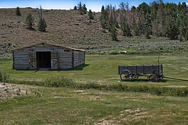
 South Pass City in 1870, three years after gold was discovered South Pass City in 1870, three years after gold was discovered | |
  | |
| Location | South Pass Rd., South Pass City, Fremont County, Wyoming |
|---|---|
| Coordinates | 42°28′06″N 108°47′59″W / 42.46833°N 108.79972°W / 42.46833; -108.79972 |
| Built | 1867 |
| NRHP reference No. | 70000670 |
| Added to NRHP | February 26, 1970 |
South Pass City is an unincorporated community in Fremont County, Wyoming, United States. It is located 2 miles (3 km) south of the intersection of highways 28 and 131. A former station on the Oregon Trail, it became a ghost town after later gold mines were closed. The entire community is listed on the National Register of Historic Places. The closest town is Atlantic City.
History
South Pass City developed rapidly as a stage and telegraph station on the Oregon Trail during the 1850s. The site of the first settlement in the area was about 9 miles (14 km) south of present-day South Pass City, at what is today known as Burnt Ranch. Burnt Ranch was located where the Emigrant Trails crossed the Sweetwater River for the last time and ascended toward the South Pass.
In August 1861, 25-year-old Samuel Clemens (later Mark Twain) passed through South Pass City via stagecoach with his brother Orion, newly appointed as Secretary of Nevada Territory. Mark Twain later wrote about the experience in Roughing It, first published in 1872: "... we hove in sight of South Pass City. The hotelkeeper, the postmaster, the blacksmith, the mayor, the constable, the city marshal and the principal citizen and property holder, all came out and greeted us cheerily, and we gave him good day. He gave us a little Indian news, and a little Rocky Mountain news, and we gave him some Plains information in return. He then retired to his lonely grandeur and we climbed on up among the bristling peaks and the ragged clouds. South Pass City consisted of four log cabins, one of which was unfinished, and the gentleman with all those offices and titles was the chiefest of the ten citizens of the place. Think of hotelkeeper, postmaster, blacksmith, mayor, constable, city marshal and principal citizen all condensed into one person and crammed into one skin. Bemis said he was 'a perfect Allen's revolver of dignities.' And he said that if he were to die as postmaster, or as blacksmith, or as postmaster and blacksmith both, the people might stand it; but if he were to die all over, it would be a frightful loss to the community."
In 1867, gold was discovered in the vicinity, and a year later prospecting began on what would become the Carissa mine. Prospectors and adventurers quickly arrived and founded South Pass City. Within a year, the community's population had swelled to about 2,000. William H. Bright, a saloon owner who was elected to the Wyoming Territorial Legislature and served as President of the Territorial Council, introduced a women's suffrage bill, which passed. When the Women's Suffrage Act was signed into law by Territorial Governor John A. Campbell on December 10, 1869, Wyoming became the first jurisdiction in the United States to grant women the right to vote, a right which was not granted women nationally until 1920.
Esther Hobart Morris became the first female justice of the peace in the United States in 1870. She began her tenure as justice in South Pass City on February 14, 1870, serving a term of nearly 9 months. The Sweetwater County Board of County Commissioners appointed Morris as justice of the peace after the previous justice, R.S. Barr, resigned in protest of Wyoming Territory's passage of the women's suffrage amendment in December 1869.
Within a decade, the city's population shrank dramatically, as the large gold deposits that had been hoped for failed to materialize. By the mid-1870s South Pass City's population was reduced to about 100 people but apparently grew to 180 by 1901. Over the next century the population of South Pass City declined even further. Many of the city's homes, mercantile stores, hotels and saloons fell into disrepair. A few businesses continued to operate in South Pass City, with the last of the pioneer families finally moving out in 1949.
South Pass City State Historic Site
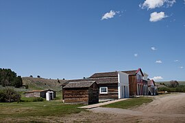
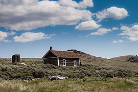
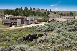
By the end of the 20th century, steps were being taken to renew the community, and to develop it as an historic site for destination tourism. The community in the early 21st century consists of two areas: South Pass City, in which a handful of residents live, and South Pass City State Historic Site, which preserves more than 30 historic structures dating from the city's heyday in the 1860s and 1870s. In 1970, the community was added to the National Register of Historic Places.
The town has been extensively documented by the Historic American Buildings Survey (HABS) in drawings and in photographs, by HABS photographer Jack Boucher.
In 2003, the Wyoming State Legislature purchased the Carissa Mine and added the property to the South Pass City State Historic Site. The Carissa Mine was the main economic engine for South Pass City for many years. Wyoming State Parks partnered with the Abandoned Mine Lands division of the Department of Environmental Quality to remediate mine hazards and stabilize buildings. Additional support from the Wyoming State Legislature and organizations like the Friends of South Pass City have raised funds for restoration and exhibition of the mine. Today the mine buildings can be toured with demonstrations of historic mining and milling equipment.
Highways
The road west out of South Pass City intersects with ![]() WYO 28 two miles (3 km) west of town; Wyo. 28 intersects with
WYO 28 two miles (3 km) west of town; Wyo. 28 intersects with ![]() US 287 thirty-five miles north of that intersection.
US 287 thirty-five miles north of that intersection.
Climate
| Climate data for South Pass City, Wyoming, 1991–2020 normals, 1900–2020 extremes: 7840ft (2390m) | |||||||||||||
|---|---|---|---|---|---|---|---|---|---|---|---|---|---|
| Month | Jan | Feb | Mar | Apr | May | Jun | Jul | Aug | Sep | Oct | Nov | Dec | Year |
| Record high °F (°C) | 60 (16) |
53 (12) |
68 (20) |
75 (24) |
83 (28) |
93 (34) |
98 (37) |
102 (39) |
87 (31) |
80 (27) |
65 (18) |
62 (17) |
102 (39) |
| Mean maximum °F (°C) | 42.8 (6.0) |
41.7 (5.4) |
52.1 (11.2) |
63.5 (17.5) |
73.5 (23.1) |
80.8 (27.1) |
85.9 (29.9) |
84.2 (29.0) |
78.9 (26.1) |
69.3 (20.7) |
51.6 (10.9) |
42.4 (5.8) |
80.4 (26.9) |
| Mean daily maximum °F (°C) | 28.0 (−2.2) |
29.2 (−1.6) |
38.3 (3.5) |
47.4 (8.6) |
58.5 (14.7) |
69.7 (20.9) |
77.6 (25.3) |
76.6 (24.8) |
67.2 (19.6) |
52.7 (11.5) |
37.2 (2.9) |
27.7 (−2.4) |
50.8 (10.5) |
| Daily mean °F (°C) | 15.2 (−9.3) |
16.7 (−8.5) |
25.3 (−3.7) |
33.4 (0.8) |
43.3 (6.3) |
52.2 (11.2) |
59.2 (15.1) |
57.5 (14.2) |
49.1 (9.5) |
37.6 (3.1) |
24.4 (−4.2) |
15.4 (−9.2) |
35.8 (2.1) |
| Mean daily minimum °F (°C) | 2.4 (−16.4) |
4.1 (−15.5) |
12.3 (−10.9) |
19.3 (−7.1) |
28.0 (−2.2) |
34.7 (1.5) |
40.8 (4.9) |
38.4 (3.6) |
31.0 (−0.6) |
22.6 (−5.2) |
11.7 (−11.3) |
3.0 (−16.1) |
20.7 (−6.3) |
| Mean minimum °F (°C) | −18.8 (−28.2) |
−20.7 (−29.3) |
−9.5 (−23.1) |
5.4 (−14.8) |
15.1 (−9.4) |
24.4 (−4.2) |
31.3 (−0.4) |
28.8 (−1.8) |
19.6 (−6.9) |
4.3 (−15.4) |
−12.9 (−24.9) |
−19.4 (−28.6) |
−22.0 (−30.0) |
| Record low °F (°C) | −45 (−43) |
−40 (−40) |
−33 (−36) |
−22 (−30) |
0 (−18) |
6 (−14) |
18 (−8) |
9 (−13) |
−5 (−21) |
−26 (−32) |
−30 (−34) |
−46 (−43) |
−46 (−43) |
| Average precipitation inches (mm) | 0.92 (23) |
0.62 (16) |
0.74 (19) |
1.34 (34) |
1.92 (49) |
1.33 (34) |
0.86 (22) |
0.95 (24) |
1.13 (29) |
0.98 (25) |
0.96 (24) |
0.89 (23) |
12.64 (322) |
| Average snowfall inches (cm) | 19.5 (50) |
19.0 (48) |
15.9 (40) |
19.3 (49) |
9.6 (24) |
0.7 (1.8) |
0.0 (0.0) |
0.0 (0.0) |
3.5 (8.9) |
12.1 (31) |
15.0 (38) |
21.5 (55) |
136.1 (345.7) |
| Source 1: NOAA (1981-2010 precipitation) | |||||||||||||
| Source 2: XMACIS2 (1991-2003 snowfall, records & monthly max/mins) | |||||||||||||
Popular culture
In The Outlaw Trail: A Journey Through Time, Robert Redford devoted a chapter to South Pass City.
Gallery
References
- "Ninth Crossing of the Sweetwater (Burnt Ranch)". Wyoming State Historic Preservation Office. Retrieved September 15, 2008.
- Twain, Mark (1985). Roughing It. Penguin Classics. pp. 121-22. ISBN 0140390103.
- ^ Weis, Norman D. (1971). Ghost Towns of the Northwest. Caldwell, Idaho: The Caxton Printers Ltd. ISBN 0-87004-201-7.
- ^ Cummings, Kathryn Swim (2019). Esther Hobart Morris, The Unembellished Story of the Nation's First Female Judge. Glendo, WY: High Plains Press.
- ^ Delbride, Rena. "Trailblazer: Wyoming's first female judge, Esther Hobart Morris was ahead of her time". Made in Wyoming, Our Legacy of Success. Archived from the original on April 26, 2009. Retrieved February 4, 2009.
- Cheney, Lynne (April 1973). "It all began in Wyoming". American Heritage. Archived from the original on April 26, 2009.
- ^ Bill Barnhart, Assistant Historian (December 19, 1969). "South Pass City". National Register of Historic Places Nomination Form. National Park Service. Retrieved September 5, 2017.
- International Atlas: The United States, the World Indexed. John W. Iliff & Company. 1901. p. 254. Retrieved October 13, 2019.
- "South Pass City State Historic Site". Wyoming State Parks, Historic Sites & Trails. State of Wyoming. Retrieved September 5, 2017.
- "Top Stops Along Wyoming's Continental Divide Trail, Subtitle: South Pass City State Historic Site". Retrieved October 13, 2019.
- "South Pass City, Wyoming 1991-2020 Monthly Normals". Retrieved November 21, 2023.
- "South Pass City, Wyoming 1981-2010 Monthly Normals". Retrieved November 21, 2023.
- "xmACIS". National Oceanic and Atmospheric Administration. Retrieved November 21, 2023.
- Redford, Robert (1976). The Outlaw Trail: A Journey Through Time. New York: Grosset & Dunlap. pp. 80–95. ISBN 0448145901.
External links
- South Pass City Historic Site Friends of South Pass
- South Pass City State Historic Site Wyoming State Parks, Historic Sites & Trails
- South Pass City Wyoming State Historic Preservation Office
- City of Gold: The Story of South Pass City Documentary produced by Wyoming PBS
- South Pass City Prints & Photographs Online Catalog of the Library of Congress
| Municipalities and communities of Fremont County, Wyoming, United States | ||
|---|---|---|
| County seat: Lander | ||
| Cities |  | |
| Towns | ||
| CDPs | ||
| Unincorporated communities | ||
| Ghost town | ||
| Indian reservation | ||
| National Register of Historic Places in Fremont County, Wyoming | ||
|---|---|---|
| National Historic Landmark | ||
| Historic districts |
| |
| Historic properties |
| |
| See also: National Register of Historic Places listings in Fremont County, Wyoming and List of National Historic Landmarks in Wyoming | ||
- 1867 establishments in Dakota Territory
- Ghost towns in Wyoming
- Historic American Buildings Survey in Wyoming
- Historic districts on the National Register of Historic Places in Wyoming
- Mining communities in Wyoming
- Mining museums in the United States
- Museums in Fremont County, Wyoming
- Open-air museums in Wyoming
- Populated places established in 1867
- Unincorporated communities in Fremont County, Wyoming
- Unincorporated communities in Wyoming
- Wyoming state historic sites
- National Register of Historic Places in Fremont County, Wyoming
- Populated places on the National Register of Historic Places in Wyoming
- IUCN Category III

