| Spiennes Spiene (Walloon) | |
|---|---|
| Sub-municipality of Mons | |
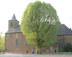
 Saint-Amand Church Saint-Amand Church | |
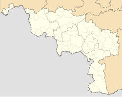
| Location of Spiennes | |
 Location of Spiennes in Mons Location of Spiennes in Mons | |
  | |
| Coordinates: 50°25′09″N 3°56′38″E / 50.41917°N 3.94389°E / 50.41917; 3.94389 | |
| Country | |
| Community | |
| Region | |
| Province | |
| Arrondissement | Mons |
| Municipality | Mons |
| Area | |
| • Total | 5.370 km (2.073 sq mi) |
| Population | |
| • Total | 976 |
| • Density | 180/km (470/sq mi) |
| Postal codes | 7032 |
| Area codes | 065 |
Spiennes (French pronunciation: [spjɛn]; Walloon: Spiene) is a sub-municipality of the city of Mons located in the province of Hainaut, Wallonia, Belgium. It was a separate municipality until 1977. On 1 January 1977, it was merged into Mons.
Heritage
The locality is well known for its neolithic flint mines, which are on the list of UNESCO World Heritage Sites since 2000.
References
- "LISTE ALPHABETIQUE DES COMMUNES - Fusions de 1963 à 1977" (PDF).
- "Neolithic Flint Mines of Petit-Spiennes : Official web site". Archived from the original on 2007-12-31. Retrieved 2007-12-16.
| Populated places in Mons | |
|---|---|
| Sub-municipalities | |
| Villages and hamlets | |
This Hainaut Province location article is a stub. You can help Misplaced Pages by expanding it. |
- "Spiennes (Mons, Hainaut Province (Sub-Municipalities), Belgium) - Population Statistics, Charts, Map, Location, Weather and Web Information". www.citypopulation.de. Retrieved 2024-10-31.