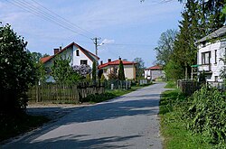
| Stary Kiełbów | |
|---|---|
| Village | |
 | |
 | |
| Coordinates: 51°33′51″N 21°00′06″E / 51.56417°N 21.00167°E / 51.56417; 21.00167 | |
| Country | |
| Voivodeship | Masovian |
| County | Białobrzegi |
| Gmina | Stara Błotnica |
| Time zone | UTC+1 (CET) |
| • Summer (DST) | UTC+2 (CEST) |
| Vehicle registration | WBR |
| Primary airport | Radom Airport |
Stary Kiełbów is a village in the administrative district of Gmina Stara Błotnica, within Białobrzegi County, Masovian Voivodeship, in east-central Poland.
History
Stary Kiełbów was the location of a motte-and-bailey castle from the 13th-14th century, located on a trade route which connected Radom and Grójec. It is now an archaeological site. Since the 1960s, archaeologists discovered fragments of medieval pottery and armor in the village. In the following centuries, Kiełbów was a private village of Polish nobility, administratively located in the Radom County in the Sandomierz Voivodeship in the Lesser Poland Province of the Polish Crown.
Transport
The Voivodeship road 732 runs through the village, and the Expressway S7, part of the European route E77, runs nearby, east of the village.
References
- "Central Statistical Office (GUS) – TERYT (National Register of Territorial Land Apportionment Journal)" (in Polish). 2008-06-01.
- ^ Agnieszka Oniszczuk. "Gródek stożkowaty". Zabytek.pl (in Polish). Retrieved 28 August 2021.
- Województwo sandomierskie w drugiej połowie XVI wieku; Cz.1, Mapy, plany (in Polish). Warsaw: Wydawnictwo Naukowe PWN. 1993. p. 3.
| Gmina Stara Błotnica | ||
|---|---|---|
| Seat |  | |
| Other villages | ||
This Białobrzegi County location article is a stub. You can help Misplaced Pages by expanding it. |