| Sydney Street | ||||||||||||||||
|---|---|---|---|---|---|---|---|---|---|---|---|---|---|---|---|---|
 | ||||||||||||||||
| General information | ||||||||||||||||
| Location | Sydney Street, New Farm Australia | |||||||||||||||
| Coordinates | 27°28′29″S 153°02′33″E / 27.4747°S 153.0424°E / -27.4747; 153.0424 | |||||||||||||||
| Owned by | Brisbane City Council | |||||||||||||||
| Operated by | RiverCity Ferries | |||||||||||||||
| Platforms | 1 | |||||||||||||||
| Construction | ||||||||||||||||
| Accessible | Yes | |||||||||||||||
| Other information | ||||||||||||||||
| Station code | 317589 | |||||||||||||||
| Fare zone | go card 1 | |||||||||||||||
| History | ||||||||||||||||
| Closed | 4 January 2015 | |||||||||||||||
| Rebuilt | 6 May 2015 | |||||||||||||||
| Services | ||||||||||||||||
| ||||||||||||||||
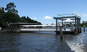
Sydney Street ferry wharf is located on the northern side of the Brisbane River serving the Brisbane suburb of New Farm in Queensland, Australia. It is served by RiverCity Ferries' CityCat and CityHopper services.
History
The wharf was destroyed during the January 2011 Brisbane floods. A temporary replacement opened on 18 April 2011.
The temporary wharf closed in January 2015 to allow a new permanent wharf to be built. The new wharf opened on 6 May 2015.
References
- Sydney Street wharf timetable TransLink
- "CityCat timetable" (PDF). Translink. 15 November 2020.
- "CityHopper timetable" (PDF). Translink. 15 November 2020. pp. 1–2.
- List: CityCat, CityFerry terminal damage Brisbane Times 20 January 2011
- CityCat Community Update, Brisbane City Council
- Sydney Street Ferry Terminal Upgrade Community Newsletter # 2 Archived 4 March 2015 at the Wayback Machine Brisbane City Council December 2014
- Sydney Street CityCat stop closes for upgrade Archived 10 May 2017 at the Wayback Machine Brisbane Times 2 January 2015
- Sydney Street ferry terminal upgrade Brisbane City Council 14 May 2015
External links
![]() Media related to Sydney Street ferry wharf at Wikimedia Commons
Media related to Sydney Street ferry wharf at Wikimedia Commons
| CityCat | |
|---|---|
| CityHopper | |
|---|---|