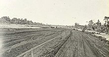
| Tadji Airport | |||||||||||
|---|---|---|---|---|---|---|---|---|---|---|---|
| Summary | |||||||||||
| Location | Tadji, Papua New Guinea | ||||||||||
| Elevation AMSL | 16 ft / 5 m | ||||||||||
| Coordinates | 3°11′56.4″S 142°25′42″E / 3.199000°S 142.42833°E / -3.199000; 142.42833 | ||||||||||
| Map | |||||||||||
 | |||||||||||
| Runways | |||||||||||
| |||||||||||
| Source: PNG Airstrip Guide | |||||||||||
Tadji Airport (IATA: TAJ) is an airfield serving Tadji, near Aitape, in the Sandaun Province of Papua New Guinea.
History

The airport was built by the Japanese in 1942 and was seized by the Allies as a part of Operation Persecution during April 1944.
Airlines and destinations
(no known scheduled services)
References
- ^ PNG Airstrip Guide. August 2005.
External links
This article about an Oceanian airport is a stub. You can help Misplaced Pages by expanding it. |
This article about a Papua New Guinean building or structure related topic is a stub. You can help Misplaced Pages by expanding it. |