Village in Leinster, Ireland
| Tagoat Teach Gót | |
|---|---|
| Village | |
 Village and N25 road Village and N25 road | |
 | |
| Coordinates: 52°14′38″N 6°23′20″W / 52.244°N 6.389°W / 52.244; -6.389 | |
| Country | Ireland |
| Province | Leinster |
| County | County Wexford |
| Time zone | UTC+0 (WET) |
| • Summer (DST) | UTC-1 (IST (WEST)) |
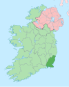
Tagoat (Irish: Teach Gót) is a village in County Wexford, Ireland. It is located on the N25 and R736 roads, to the west of Rosslare Harbour.
The village is located in the historic barony of Forth. It has a Roman Catholic church and a GAA team dedicated to St. Mary.
See also
References
- "Teach Gót / Tagoat". logainm.ie. Irish Placenames Commission. Retrieved 25 July 2020.
- "Tagoat". Mapcarta. Retrieved 24 July 2020.
- Thom, Alexander (1859). Thom's Almanac and Official Directory of the United Kingdom of Great Britain and Ireland for the Year. Thom.
- "Tagoat". Topographical Dictionary of Ireland. Samuel Lewis. 1837.
- "Tagoat | The Schools' Collection". dúchas.ie. Retrieved 24 July 2020.
This article related to the geography of County Wexford, Ireland is a stub. You can help Misplaced Pages by expanding it. |
