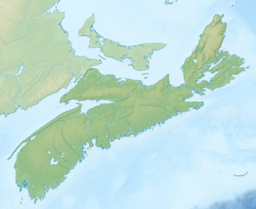
| Tangier Grand Lake | |
|---|---|
 Fox Point, located near the centre of Tangier Grand Lake Fox Point, located near the centre of Tangier Grand Lake | |
 | |
| Location | Halifax Regional Municipality, Nova Scotia |
| Coordinates | 44°53′18″N 62°49′01″W / 44.888369°N 62.816891°W / 44.888369; -62.816891 |
| Type | Glacial Lake |
| Primary inflows | Struggle Brook |
| Primary outflows | Three Rivers Lake, then Tangier River |
| Basin countries | Canada |
| Max. length | 6 kilometres (3.7 mi) |
| Max. width | 4 kilometres (2.5 mi) |
| Average depth | ~ 5 metres (16 ft) |
| Max. depth | 30 metres (98 ft) |
| Surface elevation | 60 metres (200 ft) |
| Islands | Many islands, large and small, scattered throughout the lake |
Tangier Grand Lake is a lake in the Halifax Regional Municipality of Nova Scotia, Canada. It is located near Mooseland, Nova Scotia.
Description
Tangier Grand Lake is full of islands, from the largest island, which is 600 metres (2,000 ft) long and 300 metres (980 ft) wide, to very small islands, scattered throughout the western and eastern arms. It is, for the most part, relatively shallow, but it has a relatively deep spot with a depth of approximately 30 metres (98 ft) in its centre. The lake is located on the Eastern Shore Granite Ridge, an area of 350-million year old granite bedrock.
History
The remnants of a sluice, once used in log driving, can be found on Struggle Brook, one of the primary inflows into Tangier Grand Lake from Crooked Lake.
See also
References
- "Lake Inventory Maps". Government of Nova Scotia.
- "Lake Inventory Maps". Government of Nova Scotia.
- "Tangier Grand Lake Wilderness Area". Province of Nova Scotia. 31 March 2014. Retrieved 3 February 2016.
- "Eastern Shore Lakes System". 30 October 2017.
This Halifax County, Nova Scotia location article is a stub. You can help Misplaced Pages by expanding it. |