| Tarai | |
|---|---|
| Village | |
  | |
| Coordinates: 24°41′20″N 68°40′17″E / 24.689007°N 68.671426°E / 24.689007; 68.671426 | |
| Country | Pakistan |
| Region | Sindh |
| District | Badin |
| Population | |
| • Total | 6,182 |
| Time zone | UTC+5 (PST) |
| • Summer (DST) | UTC+6 (PDT) |
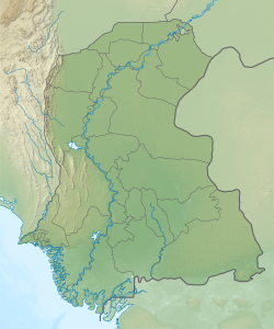
Tarai is a village and deh in Shaheed Fazil Rahu taluka of Badin District, Sindh. As of 2017, it has a population of 6,182, in 1,190 households. It is the seat of a tapedar circle, which also includes the villages of Kand, Kandar Jagir, Nari, and Shaikhano. It is also the headquarters of a supervisory tapedar circle, which also includes the tapedar circles of Akri-1, Gharo, Gunwrah, Kario, and Salehabad. Tarai is also the seat of a Union Council, which has a total population of 46,005.
Tarai's Shah Talib mosque dates back to the Kalhoro dynasty in the 1700s. It features three domes over the main sanctuary and stylistically resembles the mosque at Chuteyarun (in Sanghar District), which was built around the same time period.
References
- "GeoNames Search". geonames.nga.mil. Archived from the original on April 12, 2014. Retrieved 2023-04-19.
- ^ Population and household detail from block to tehsil level (Badin District) (PDF). 2017. p. 21. Retrieved 5 May 2021.
- "List of Dehs in Sindh" (PDF). Sindh Zameen. Retrieved 4 May 2021.
- "Union Council wise Thematic Analysis". Department of Health, Government of Sindh. Retrieved 23 May 2021.
- ^ Kalhoro, Zulfiqar Ali (2013). "The Kalhora Queen and Religious Architecture: The Mosques of Mai Jaman As Trend-Setters in Late Eighteenth-Century Sindh" (PDF). Pakistan Heritage. 5: 90–1. Retrieved 4 January 2022.
| Populated places in Badin District | |
|---|---|
| Talukas | |
| Populated places | |
| See also: Agham Kot | |
This Sindh location article is a stub. You can help Misplaced Pages by expanding it. |