| Tatasi | |
|---|---|
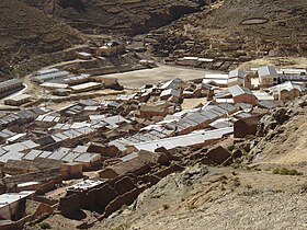
 The village Tatasi and Tatasi River The village Tatasi and Tatasi River | |
| Location | |
| Country | Bolivia |
| Region | Potosí Department |
| Municipality | Sud Chichas Province |
| Physical characteristics | |
| Mouth | Tupiza River |
| • location | Tupiza Municipality |
The Tatasi River is a Bolivian river in the Potosí Department, Sud Chichas Province, Atocha Municipality and Tupiza Municipality. It is a left tributary of the Tupiza River and belongs to the river basin of the upper Pillku Mayu.
Description
The Tatasi River is a left tributary of Tupiza River and belongs to the river basin of the upper Pillku Mayu. It runs parallel to the nearby Alexandrabetha river, which both join into the Tupiza River. It flows from the village Tatasi until joining the Tupiza River near Oro Ingenio, northwest of Tupiza. Its direction is mainly southeast.
The river flows from the village Tatasi until joining the Tupiza River near Oro Ingenio, northwest of Tupiza. Its direction is mainly southeast.
Contamination
In 2003, traces of lead were discovered in schoolchildren who lived in the nearby village and had dranken from the water. This was believed to be caused by the nearby Tatasi-Portugalete Mine, which was mining for silver and lead. Because of this, COMNIBOL (Bolivia's state mining corporation) and the Danish environmental cooperation program (PCDSMA) invested $654,000 into fixing the canals and waterways in the area to make it safer. The mining and hydrocarbons minister, Jorge Berindoague, officially opened the project in late 2003. The project was designed to make the water safe within five years.
Area climate
| ||||||||||||||||||||||||||||||||||||||||||||||||||||||||||||||||||||||||||||||||||||||||||||||||||||||||||||||||||||||||||||
See also
References
- Atocha Municipality: population data and map
- ^ Jorge Molina Carpio, Daniel Espinoza Romero, Balance hídrico superficial de la cuenca alta del río Pilcomayo, La Paz 2005 (Spanish)
- "Flood in Bolivia - Activations - International Disasters Charter". disasterscharter.org. Retrieved 2020-04-30.
- "BNamericas - Comibol, Danes pump US$654,000 into Tatasi". BNamericas.com. Retrieved 2020-04-30.
- "NASA Earth Observations Data Set Index". NASA. Retrieved 30 January 2016.
21°10′S 66°08′W / 21.167°S 66.133°W / -21.167; -66.133
| Locations | ||
|---|---|---|