| Tehta | |||||||||||
|---|---|---|---|---|---|---|---|---|---|---|---|
| Indian Railways station | |||||||||||
| General information | |||||||||||
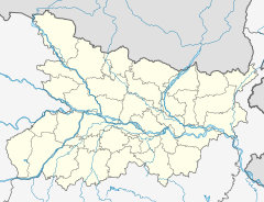
| Location | National Highway 83, Tehta, Jehanabad district, Bihar India | ||||||||||
| Coordinates | 25°06′47″N 84°59′06″E / 25.113068°N 84.985023°E / 25.113068; 84.985023 | ||||||||||
| Elevation | 76 metres (249 ft) | ||||||||||
| Owned by | Indian Railways | ||||||||||
| Operated by | East Central Railway | ||||||||||
| Platforms | 2 | ||||||||||
| Tracks | 2 | ||||||||||
| Construction | |||||||||||
| Structure type | Standard (on ground station) | ||||||||||
| Other information | |||||||||||
| Status | Functioning | ||||||||||
| Station code | THA | ||||||||||
| Zone(s) | East Central Railway | ||||||||||
| Division(s) | Danapur | ||||||||||
| History | |||||||||||
| Opened | 1900; 125 years ago (1900) | ||||||||||
| Electrified | Yes | ||||||||||
| Services | |||||||||||
| |||||||||||
| |||||||||||
Tehta railway station is a railway station on the Patna–Gaya line under Danapur railway division of the East Central Railway zone. The station is situated beside National Highway 83 at Tehta in Jehanabad district in the Indian state of Bihar.
History
Gaya was connected to Patna in 1900 by East Indian Railway Company by Patna–Gaya line. The Gaya to Jahanabad was electrified in 2002–2003. Electrification of the Patna–Gaya line was completed in 2003.
References
- राजपूताना ⚔️, ⚔️ जय. "Tehta Railway Station Map/Atlas ECR/East Central Zone – Railway Enquiry". India Rail Info. Retrieved 2020-10-28.
- "IR History:Early days II (1870–1899)". Retrieved 27 October 2020.
- "History of Electrification". IRFCA. Retrieved 28 October 2020.
- "Patna–Gaya rail electrification project". Process Register. Retrieved 28 October 2020.
This article about a railway station in the Indian state of Bihar is a stub. You can help Misplaced Pages by expanding it. |

