Village in Illinois, United States
| Thornton, Illinois | |
|---|---|
| Village | |
 | |
 Seal Seal | |
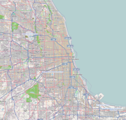
 Location of Thornton in Cook County, Illinois. Location of Thornton in Cook County, Illinois. | |
   | |
| Coordinates: 41°34′17″N 87°36′42″W / 41.57139°N 87.61167°W / 41.57139; -87.61167 | |
| Country | United States |
| State | Illinois |
| County | Cook |
| Township | Thornton |
| Founded | 1834 |
| Incorporated | 1900 |
| Government | |
| • Type | Council-Trustee |
| • Body | Board of Trustees |
| • Village president | Joseph Pisarzewski (Acting) |
| • Clerk | Nikki Kitakis |
| Area | |
| • Total | 2.40 sq mi (6.22 km) |
| • Land | 2.38 sq mi (6.15 km) |
| • Water | 0.03 sq mi (0.07 km) |
| Elevation | 620 ft (190 m) |
| Population | |
| • Total | 2,386 |
| • Density | 1,004.63/sq mi (387.96/km) |
| Time zone | UTC-6 (CST) |
| • Summer (DST) | UTC-5 (CDT) |
| ZIP code | 60476 |
| Area code | 708 |
| FIPS code | 17-75185 |
| GNIS feature ID | 2399975 |
| Website | www |
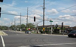
Thornton is a village in Cook County, Illinois, United States, and a south suburb of Chicago. The population was 2,386 at the 2020 census. Thornton is home to the Thornton Quarry, one of the largest quarries in the world.
Geography
Thornton is located at 41°34′17″N 87°36′42″W / 41.57139°N 87.61167°W / 41.57139; -87.61167 (41.571484, -87.611743).
According to the 2021 census gazetteer files, Thornton has a total area of 2.40 square miles (6.22 km), of which 2.38 square miles (6.16 km) (or 98.92%) is land and 0.03 square miles (0.08 km) (or 1.08%) is water.
Demographics
| Census | Pop. | Note | %± |
|---|---|---|---|
| 1860 | 1,033 | — | |
| 1870 | 301 | −70.9% | |
| 1910 | 1,030 | — | |
| 1920 | 767 | −25.5% | |
| 1930 | 1,012 | 31.9% | |
| 1940 | 1,101 | 8.8% | |
| 1950 | 1,217 | 10.5% | |
| 1960 | 2,895 | 137.9% | |
| 1970 | 3,714 | 28.3% | |
| 1980 | 3,024 | −18.6% | |
| 1990 | 2,778 | −8.1% | |
| 2000 | 2,582 | −7.1% | |
| 2010 | 2,338 | −9.5% | |
| 2020 | 2,386 | 2.1% | |
| U.S. Decennial Census 2010 2020 | |||
| Race / Ethnicity (NH = Non-Hispanic) | Pop 2000 | Pop 2010 | Pop 2020 | % 2000 | % 2010 | % 2020 |
|---|---|---|---|---|---|---|
| White alone (NH) | 2,425 | 1,841 | 1,325 | 93.92% | 78.74% | 55.53% |
| Black or African American alone (NH) | 21 | 219 | 528 | 0.81% | 9.37% | 22.13% |
| Native American or Alaska Native alone (NH) | 2 | 2 | 3 | 0.08% | 0.09% | 0.13% |
| Asian alone (NH) | 6 | 16 | 9 | 0.23% | 0.68% | 0.38% |
| Pacific Islander alone (NH) | 0 | 1 | 0 | 0.00% | 0.04% | 0.00% |
| Other race alone (NH) | 0 | 1 | 8 | 0.00% | 0.04% | 0.34% |
| Mixed race or Multiracial (NH) | 21 | 53 | 71 | 0.81% | 2.27% | 2.98% |
| Hispanic or Latino (any race) | 107 | 205 | 442 | 4.14% | 8.77% | 18.52% |
| Total | 2,582 | 2,338 | 2,386 | 100.00% | 100.00% | 100.00% |
As of the 2020 census there were 2,386 people, 960 households, and 591 families residing in the village. The population density was 993.75 inhabitants per square mile (383.69/km). There were 1,061 housing units at an average density of 441.90 per square mile (170.62/km). The racial makeup of the village was 58.63% White, 22.76% African American, 0.21% Native American, 0.38% Asian, 0.00% Pacific Islander, 9.68% from other races, and 8.34% from two or more races. Hispanic or Latino of any race were 18.52% of the population.
There were 960 households, out of which 21.8% had children under the age of 18 living with them, 41.98% were married couples living together, 14.48% had a female householder with no husband present, and 38.44% were non-families. 31.35% of all households were made up of individuals, and 16.25% had someone living alone who was 65 years of age or older. The average household size was 3.07 and the average family size was 2.39.
The village's age distribution consisted of 15.9% under the age of 18, 11.1% from 18 to 24, 24.5% from 25 to 44, 32.2% from 45 to 64, and 16.5% who were 65 years of age or older. The median age was 43.8 years. For every 100 females, there were 92.2 males. For every 100 females age 18 and over, there were 87.2 males.
The median income for a household in the village was $66,447, and the median income for a family was $85,375. Males had a median income of $41,890 versus $39,329 for females. The per capita income for the village was $32,251. About 2.7% of families and 8.0% of the population were below the poverty line, including 4.6% of those under age 18 and 14.5% of those age 65 or over.
Government
Thornton is in Illinois's 2nd congressional district.
Transportation
Pace provides bus service on Route 353 connecting Thornton to destinations across the Southland.
References
- "Village President". Retrieved October 20, 2014.
- "2020 U.S. Gazetteer Files". United States Census Bureau. Retrieved March 15, 2022.
- ^ U.S. Geological Survey Geographic Names Information System: Thornton, Illinois
- "Thornton village, Illinois". United States Census Bureau. Retrieved January 26, 2022.
- "US Gazetteer files: 2010, 2000, and 1990". United States Census Bureau. February 12, 2011. Retrieved April 23, 2011.
- "Gazetteer Files". Census.gov. United States Census Bureau. Retrieved June 29, 2022.
- "Decennial Census of Population and Housing by Decades". US Census Bureau.
- ^ "P2 Hispanic or Latino, and Not Hispanic or Latino by Race – 2010: DEC Redistricting Data (PL 94-171) - Thornton village, Illinois". United States Census Bureau.
- ^ "P2 Hispanic or Latino, and Not Hispanic or Latino by Race – 2020: DEC Redistricting Data (PL 94-171) – Thornton village, Illinois". United States Census Bureau.
- "P004: Hispanic or Latino, and Not Hispanic or Latino by Race – 2000: DEC Summary File 1 – Thornton village, Illinois". United States Census Bureau. Retrieved January 26, 2024.
- "Explore Census Data". data.census.gov. Retrieved June 28, 2022.
- "RTA System Map" (PDF). Retrieved February 1, 2024.
External links
| Chicago metropolitan area | ||
|---|---|---|
| Major city |  | |
| Cities (over 30,000 in 2020) | ||
| Towns and villages (over 30,000 in 2020) |
| |
| Counties | ||
| Regions | ||
| Sub-regions | ||
| Illinois, United States | ||
| Places adjacent to Thornton, Illinois | ||||||||||||||||
|---|---|---|---|---|---|---|---|---|---|---|---|---|---|---|---|---|
| ||||||||||||||||
