You can help expand this article with text translated from the corresponding article in Hungarian. (June 2023) Click for important translation instructions.
|
| Tikos | |
|---|---|
| Village | |
 Coat of arms Coat of arms | |
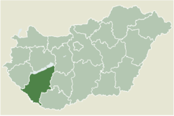
 Location of Somogy county in Hungary Location of Somogy county in Hungary | |
 | |
| Coordinates: 46°38′08″N 17°17′17″E / 46.63543°N 17.28801°E / 46.63543; 17.28801 | |
| Country | |
| Region | Southern Transdanubia |
| County | Somogy |
| District | Marcali |
| RC Diocese | Kaposvár |
| Area | |
| • Total | 3.35 km (1.29 sq mi) |
| Population | |
| • Total | 121 |
| Demonym | tikosi |
| Time zone | UTC+1 (CET) |
| • Summer (DST) | UTC+2 (CEST) |
| Postal code | 8731 |
| Area code | (+36) 85 |
| Motorways | M7 |
| Distance from Budapest | 177 km (110 mi) Northeast |
| NUTS 3 code | HU232 |
| MP | József Attila Móring (KDNP) |
| Website | Tikos Online |
The postal code of Tikos is 8731. The village is located at the foot of Lake Balaton, about 180 km (110 mi) southeast of Budapest.
History
According to László Szita the settlement was completely Hungarian in the 18th century.
External links
References
- Tikos, KSH
- "Postal Codes Somogy, Hungary". www.geonames.org. Retrieved 2017-06-24.
- László Szita : Somogy megyei nemzetiségek településtörténete a XVIII-XIX. században - Somogyi Almanach 52. (Kaposvár, 1993)
This Somogy county location article is a stub. You can help Misplaced Pages by expanding it. |

