Mountain in Washington (state), United States
| This article is an orphan, as no other articles link to it. Please introduce links to this page from related articles; try the Find link tool for suggestions. (September 2022) |
| Tokaloo Rock | |
|---|---|
 Looking up at the Tokaloo Rock summit Looking up at the Tokaloo Rock summit | |
| Highest point | |
| Elevation | 7,688 ft (2,343 m) |
| Prominence | 204 ft (62 m) |
| Parent peak | Glacier Island (7,690 ft) |
| Isolation | 1.45 mi (2.33 km) |
| Coordinates | 46°50′22″N 121°50′26″W / 46.839307°N 121.840651°W / 46.839307; -121.840651 |
| Geography | |
  | |
| Location | Mount Rainier National Park Pierce County, Washington, US |
| Parent range | Cascades |
| Climbing | |
| Easiest route | scrambling from St. Andrew's Park, off of the Wonderland Trail |
Tokaloo Rock is a 7,688 feet (2,343 m) mountain located in Mount Rainier National Park, in Pierce County of Washington state. It is part of the Cascade Range, and lies 4 mi (6.4 km) west of the summit of Mount Rainier, near the head of the North Puyallup River and at the foot of the Puyallup Glacier. The Wonderland Trail provides an approach to this mountain, and the summit offers views of Mount Rainier's Puyallup and Tahoma glaciers. Glacier Island is its nearest higher neighbor, 1.45 mi (2.33 km) to the southeast. Tokaloo Spire is a pillar adjacent to Tokaloo Rock and rises to an elevation of 7,471 feet (2,277 m).
History
Tokaloo Rock's name was officially adopted in 1932 by the United States Board on Geographic Names.
Climate
Mineral Mountain is located in the marine west coast climate zone of western North America. Most weather fronts originate in the Pacific Ocean, and travel northeast toward the Cascade Mountains. As fronts approach, they are forced upward by the peaks of the Cascade Range (Orographic lift), causing them to drop their moisture in the form of rain or snowfall onto the Cascades. As a result, the west side of the Cascades experiences high precipitation, especially during the winter months in the form of snowfall. During winter months, weather is usually cloudy, but, due to high-pressure systems over the Pacific Ocean that intensify during summer months, there is often little or no cloud cover during the summer.
-
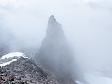
 Tokaloo Spire shrouded in clouds
-
 Approaching Tokaloo Spire. Tokaloo Rock's summit is hidden beyond the ridge.
See also
References
- ^ "Mineral Mountain, Washington". Peakbagger.com.
- ^ "Tokaloo Rock – 7,684' WA". listsofjohn.com. Retrieved September 15, 2022.
- ^ Beckey, Fred W. Cascade Alpine Guide, Climbing and High Routes. Seattle, WA: Mountaineers Books, 2008.
- ^ "Tokaloo Rock". Geographic Names Information System. United States Geological Survey, United States Department of the Interior. Retrieved September 15, 2022.
- "Tokaloo Spire". Geographic Names Information System. United States Geological Survey, United States Department of the Interior. Retrieved September 15, 2022.
External links
- National Park Service web site: Mount Rainier National Park
| Places adjacent to Tokaloo Rock | ||||||||||||||||
|---|---|---|---|---|---|---|---|---|---|---|---|---|---|---|---|---|
| ||||||||||||||||