| Tomarata Lake | |
|---|---|
 Jetskiing at Tomarata Lake in 2022 Jetskiing at Tomarata Lake in 2022 | |
 | |
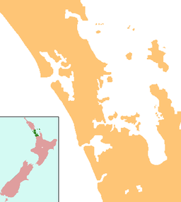
| Location | Auckland Region, North Island, New Zealand |
| Coordinates | 36°11′38″S 174°39′04″E / 36.194°S 174.651°E / -36.194; 174.651 |
| Primary outflows | Spectacle Lake |
| Basin countries | New Zealand |
| Max. length | 600 metres (2,000 ft) |
| Max. width | 320 metres (1,050 ft) |
| Surface area | 14.4 ha (36 acres) |
| Max. depth | 6 metres (20 ft) |
| Surface elevation | 23 m (75 ft) |
Tomarata Lake is a lake at Tomarata, Rodney in the northern Auckland Region of New Zealand.
Geography
Tomarata Lake is a sand dune lake located around 15 km (9.3 mi) northeast of Wellsford. It is adjacent to the Mangawhai Forest [ceb] and near Te Ārai Regional Park. The lake drains into Spectacle Lake, which in turn drains into Slipper Lake, and eventually flows into the Jellicoe Channel. A former sand quarry is located near the lake, which over time developed into a lake itself.
The lake was created when the Te Ārai sand dunes began to build up, preventing water from escaping the area. It is the only example of a peatland lake in the Auckland Region. The lake has no inflow streams, and is instead fed by rainwater and the surrounding wetlands.
Biodiversity
The lake is a part of the Tomarata — Te Ārai Dune Lakes biodiversity focus area, and is surrounded by extensive wetlands.
The lake is home to many threatened bird species, such as the New Zealand fernbird, Eurasian bittern and the Buff-banded rail.
Recreation
The lake is used for recreational swimming, boating and jetskiing, and is the most accessible of the northern Rodney lakes.
See also
References
- de Winton, M.D.; S. R. Elcock; A. T. Taumoepeau (June 2022), LakeSPI Assessment of 15 Auckland Lakes: 2021/2022 (PDF), National Institute of Water and Atmospheric Research, p. 2
- "Place name detail: Tomarata Lake". New Zealand Gazetteer. New Zealand Geographic Board. Retrieved 18 June 2024.
- ^ "Tomarata Lake, Auckland". NZ Topo Map. Gavin Harriss. Retrieved 11 February 2024.
- Preddey, Pulham (2017), Observations of New Zealand fairy tern (Sternula nereis davisae) foraging at Te Arai dune lakes, New Zealand, p. 88
- ^ "Tomarata — Te Ārai Dune Lakes". Tiaki Tāmaki Makaurau Conservation Auckland. Retrieved 18 June 2024.
- ^ Hussain, Ebrahim (30 April 2021), "Citizen Science to The Rescue: Getting to the Bottom of Lake Tomarata", In Depth Magazine, retrieved 18 June 2024
- ^ Auckland Council, ed. (2013), Guide to Auckland's wetlands (PDF), retrieved 11 February 2024
- Wells, Rohan (August 2016). The Impacts of Recreational Activities on Lake Tomarata's Ecology and Water Quality (PDF) (Report). Auckland Council. ISBN 978-1-927169-01-8. ISSN 2230-4533. Retrieved 18 June 2024.
- "Tomarata". Visit Wellsford. Retrieved 18 June 2024.
| Wellsford Subdivision - Rodney, Auckland, New Zealand | |
|---|---|
| Populated places | |
| Geographic features | |
| Facilities and attractions | |
| Government | |
This Auckland Region-related geography article is a stub. You can help Misplaced Pages by expanding it. |