| Torca River | |
|---|---|
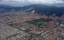
 The Torca River originates near the quarry in the Eastern Hills The Torca River originates near the quarry in the Eastern Hills | |
 | |
| Etymology | Muysccubun |
| Native name | Río Torca (Spanish) |
| Location | |
| Country | Colombia |
| Department | Cundinamarca |
| Municipalities | |
| Localities | |
| Physical characteristics | |
| Source | Eastern Hills |
| • location | Usaquén |
| • coordinates | 4°43′38.8″N 74°01′01.5″W / 4.727444°N 74.017083°W / 4.727444; -74.017083 |
| • elevation | 2,837 m (9,308 ft) |
| Mouth | Bogotá River |
| • location | Suba, Chía |
| • coordinates | 4°49′58.8″N 74°02′38.6″W / 4.833000°N 74.044056°W / 4.833000; -74.044056 |
| • elevation | 2,545 m (8,350 ft) |
| Basin size | 6,008.69 ha (23.1997 sq mi) |
| Basin features | |
| River system | Bogotá River Magdalena Basin Caribbean Sea |
| Waterbodies | Torca (wetland) |
| Bridges | Autopista Norte |
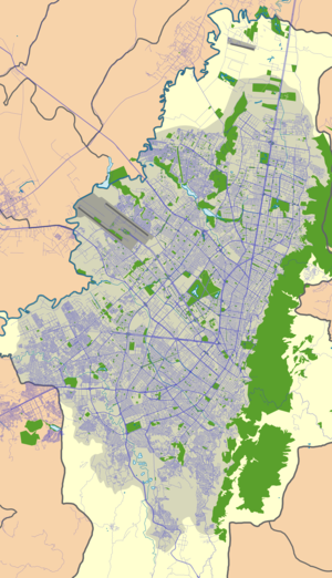
The Torca River (Spanish: Río Torca) is a river on the Bogotá savanna and a left tributary of the Bogotá River. The river, in a basin of 6,008.69 hectares (23.1997 sq mi), originates in the Eastern Hills of Bogotá at an altitude of 2,837 metres (9,308 ft). It flows in the north of the Colombian capital, through the locality of Usaquén and into the Bogotá River in Suba at the border with Chía, at 2,545 metres (8,350 ft) above sea level. The Torca wetland is located near its mouth.
Description

The Torca River originates in the Eastern Hills, in the locality of Usaquén in the north of the Colombian capital. The river enters the urban area of the city near the Bosques de Pinos complex at Carrera 6 with Calle 153. The basin of the Torca River has an area of 6,008.69 hectares (23.1997 sq mi) and along the principal axis the basin extends for 13.06 kilometres (8.12 mi). Part of its course is channelised, called El Cedro and Torca channel. The Torca River flows into the Bogotá River near the Torca wetland at the border of Bogotá and Chía. The Autopista Norte crosses the Torca River basin. The river has a high level of contamination.
Wetland
Main article: Wetlands of BogotáThe 24 hectares (0.093 sq mi) wetland of Torca is located in the Torca River basin. Amphibians registered in Torca are among others the green dotted treefrog (Hyla labialis) and the cream-backed poison frog (Colostethus subpunctatus). In Torca, 24 bird species have been registered, among others the cattle egret (Bubulcus ibis), Bogotá rail (Rallus semiplumbeus), common moorhen (Gallinula chloropus), noble snipe (Gallinago nobilis), solitary sandpiper (Tringa solitaria), grassland yellow finch (Sicalis luteola) and the endemic species to Colombia, yellow-hooded blackbird (Chrysomus icterocephalus). The flora species Carex lanuginosa was a new discovery in the Torca wetland.

See also
- List of rivers of Colombia
- Eastern Hills, Bogotá
- Bogotá savanna
- Fucha River, Juan Amarillo River, Tunjuelo River
References
- Pérez & Zamora, 2015, p.19
- Poloche Rojas, 2015, p.5
- Poloche Rojas, 2015, p.7
- Pérez Preciado, 2000, p.29
- Humedal Torca
- (in Spanish) Historia de los Humedales
- Andrade & Benitez, s.a., p.11
- Ramírez et al., 2013, p.472
- Calvachi Zambrano, 2002, p.93
Bibliography
- Andrade L., Martha Esperanza; Benitez Castañeda, Henry, Los Humedales de la Sabana de Bogotá: Área Importante para la Conservación de las Aves de Colombia y el Mundo (PDF), AICAS, pp. 1–38, retrieved 2017-03-28
- Calvachi Zambrano, Byron (2002), "La biodiversidad bogotana" (PDF), Revista la Tadeo, 67, Universidad Jorge Tadeo Lozano: 89–98, retrieved 2017-03-28
- Pérez, David Félipe; Zamora, David Andrés (2015), Descripción y contexto de las cuencas hídricas del Distrito Capital (Torca, Salitre, Fucha y Tunjuelo), Alcaldía Mayor de Bogotá, pp. 1–36, retrieved 2017-03-28
- Pérez Preciado, Alfonso (2000), La estructura ecológica principal de la Sabana de Bogotá, Sociedad Geográfica de Colombia, pp. 1–37
- Poloche Rojas, Viglemira (2015), Revisión de la documentación existentes sobre las áreas de protección de la zona de influencia del Río Frío en Chía y Río Torca en el norte de Bogotá (PDF), Universidad Militar Nueva Granada, pp. 1–18, retrieved 2017-03-28
- Ramírez, Fernando; Davenport, Thomas Lee; Kallarackal, José (2013), "Bogotá's Urban Wetlands: Environmental Issues", Current Politics and Economics of South and Central America, 6: 403–482
Further reading
- Moreno, Vanesa; García, Juan Francisco; Villalba, Juan Carlos, Descripción general de los humedales de Bogotá D.C. (PDF), Sociedad Geográfica de Colombia, pp. 1–28, retrieved 2017-03-28
External links
- (in Spanish) Sistema Hídrico, Bogotá
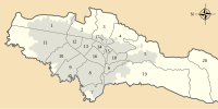
 | Administrative subdivision in 20 localities |  | |
|---|---|---|---|
| Metropolitan Area | |||
| Geography | |||
