| Trysfjorden | |
|---|---|
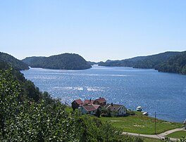
 View of the fjord View of the fjord | |
  | |
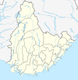
| Location | Agder county, Norway |
| Coordinates | 58°05′19″N 7°40′53″E / 58.0885°N 07.6813°E / 58.0885; 07.6813 |
| Primary outflows | Skaggerak |
| Basin countries | Norway |
| Max. length | 6.5 kilometres (4.0 mi) |
| Settlements | Trysnes, Ålo |
Trysfjorden is a fjord located in the municipality of Kristiansand in Agder county, Norway. The mouth of the 6.5-kilometre (4.0 mi) long fjord sits just west of the village of Trysnes and just northeast of the village of Ålo. The European route E39 highway runs along the inner part of the fjord, just west of the village of Lohne.
The deepest parts of the fjord reach about 85 metres (279 ft) deep. In the mud at the bottom, scientists have discovered crustaceans that they believe are indigenous to the bay. Trysfjord has several islands and islets. The islets of Storholmen, Notholmen, and Urholmen lie just outside of Røsstad. Near the villages of Trysnes and Lastad lies the island of Lastadholmen which in recent years has had the largest colony of terns in Southern Norway. The mouth of the fjord lies just south of Lastadholmen where the fjord empties into the Skaggerak.
See also
References
- Geir Thorsnæs. "Søgne". Store norske leksikon. Retrieved 2016-10-01.
- "Ålo". Søgneguiden. Retrieved 2016-10-01.
This Agder location article is a stub. You can help Misplaced Pages by expanding it. |
This article about a fjord in Norway is a stub. You can help Misplaced Pages by expanding it. |