| Uacaba Uacaba JeeresaaWakkaaba | |
|---|---|
| Village | |
 | |
| Coordinates: 12°13′N 14°27′W / 12.217°N 14.450°W / 12.217; -14.450 | |
| Country | |
| Region | Gabú Region |
| Sector | Sonaco |
| Time zone | UTC+0 (GMT) |
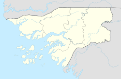
Uacaba is a village in the Gabú Region of central-eastern Guinea-Bissau. It is located 40 km north-east from Bafatá and 180 km from the capital Bissau, 120 km south-east of Guinea-Bissau – Senegal border. It has a population of 140 people.
Location
It lies between Cancurdo to the west, and Canjia to the east.
References
- "Uacaba Tourist Guide (Guinea-Bissau)". Advisor.Travel. Retrieved 2023-06-07.
- Google Maps (Map). Google.
- Bing Maps (Map). Microsoft and Harris Corporation Earthstar Geographics LLC.
External links
| Gabu Region | ||
|---|---|---|
| Gabu (capital) | ||
| Sectors | ||
| Villages | ||
This Guinea-Bissau location article is a stub. You can help Misplaced Pages by expanding it. |