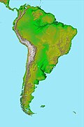
The Ucayali Peneplain is a large near-flat erosion surface, a peneplain, located in the Amazon basin. The Ucayali Peneplain is largely buried by sediments forming an unconformity. Its origin has been dated to the Miocene epoch. The Peneplain was first described in 1948 in the Contamana region of Peru.
References
- Campbell Jr., Kenneth E.; Frailey, Carl David; Romero-Pittman, Lidia (2006). "The Pan-Amazonian Ucayali Peneplain, late Neogene sedimentation in Amazonia, and the birth of the modern Amazon River system". Palaeogeography, Palaeoclimatology, Palaeoecology. 239 (1–2): 166–219. Bibcode:2006PPP...239..166C. doi:10.1016/j.palaeo.2006.01.020.
This geology article is a stub. You can help Misplaced Pages by expanding it. |
| Major South American geological features | |||||
|---|---|---|---|---|---|
| Tectonic plates |  | ||||
| Cratons and shields | |||||
| Structures undergoing subduction | |||||
| Faults and shear zones | |||||
| Rifts and grabens | |||||
| Sedimentary basins | |||||
| Orogenies | |||||
| Metallogenetic provinces | |||||
| Volcanism |
| ||||
Categories: