| Uludoruk Glacier | |
|---|---|
 Uludoruk Glaciers in September 2012 Uludoruk Glaciers in September 2012 | |
   | |
| Type | Valley glacier |
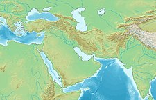
| Location | Hakkâri, Turkey |
| Coordinates | 37°30′02″N 44°00′45″E / 37.50056°N 44.01250°E / 37.50056; 44.01250 |
| Area | 8 km² |
| Length | 4 km |
| Status | Retreating |
Uludoruk Glacier is a glacier on Mount Uludoruk, one of the Taurus Mountains and the second highest mountain in Turkey. Between 1948 and 2009 the glacier retreated 12 m (39 ft) per year, due to climate change in Turkey.
See also
References
- KURTER, AJUN. "Glaciers of the Middle East and Africa: GLACIERS OF TURKEY" (PDF). U.S. Geological Survey Professional Paper. 1386-G-1.
- "Turkish Glaciers". NASA. Retrieved 23 February 2019.
This article about an Eastern Anatolia Region of Turkey location is a stub. You can help Misplaced Pages by expanding it. |