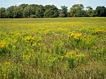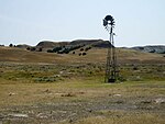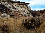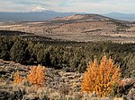

A national grassland is an area of protected and managed federal lands in the United States authorized by Title III of the Bankhead–Jones Farm Tenant Act of 1937 and managed by the United States Forest Service. For administrative purposes, they are essentially identical to national forests, except that grasslands are areas primarily consisting of prairie. Like national forests, national grasslands may be open for hunting, grazing, mineral extraction, recreation and other uses. Various national grasslands are typically administered in conjunction with nearby national forests.
All but four national grasslands are on or at the edge of the Great Plains. Those four are in southeastern Idaho, northeastern California, central Oregon, and a reserve in Illinois. The three national grasslands in North Dakota, together with one in northwestern South Dakota, are administered jointly as the Dakota Prairie Grasslands. National grasslands are generally much smaller than national forests – while a typical national forest would be about 1,000,000 acres (400,000 ha), the average size of a national grassland is 191,914 acres (77,665 ha). The largest, the Little Missouri National Grassland in North Dakota, covers 1,028,784 acres (416,334 ha), which is approximately the median size of a national forest. As of September 30, 2007, the total area of all 20 national grasslands was 3,838,280 acres (1,553,300 ha).
Soil Conservation Service
The catastrophic Dust Bowl of the 1930s led to the creation of the Soil Conservation Service in 1933. This and subsequent federal laws paved the way for establishing national grasslands.
List
Related
The smaller Midewin National Tallgrass Prairie, created much later and east of the Mississippi River, is technically not a "National Grassland", as it was formed under different legislation, but it is managed by the Forest Service like one, as a unique prairie resource.
| Name | Photo | Location | Date formed | Area | Description |
|---|---|---|---|---|---|
| Midewin National Tallgrass Prairie | 
|
Illinois 41°22′44″N 88°06′46″W / 41.37889°N 88.11278°W / 41.37889; -88.11278 (NAME) |
1996 | 20,283 acres (82.1 km) | The only federally managed prairie east of the Mississippi River, Midewin is in the Central forest-grasslands transition ecoregion and was created when land was transferred to the U.S. Forest Service from the U.S. Army. In 2015, a small research herd of American Bison were reintroduced to study the effect of this large prairie animal on tallgrass prairie regeneration. |
See also
Map all coordinates using OpenStreetMapDownload coordinates as:
- Temperate grasslands, savannas, and shrublands
- List of protected grasslands of North America
- List of U.S. National Forests
- Wilderness preservation systems in the United States
References
- ^ "Land Areas of the National Forest System". U.S. Forest Service. January 2013. Retrieved December 21, 2012.
- "U.S. Board on Geographic Names". U.S. Geological Survey. Retrieved December 21, 2012.
- "The National Grasslands Story". US Forest Service. 2023-05-25. Retrieved 2024-02-14.
- "Midewin National Tallgrass Prairie". Geographic Names Information System. United States Geological Survey, United States Department of the Interior. Retrieved December 22, 2012.
- https://www.fs.usda.gov/midewin


