Village in Andhra Pradesh, India
| Upamaka Upmaka agraharam | |
|---|---|
| village | |
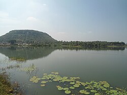
 View of Upamaka cave temple hill near Nakkapalli View of Upamaka cave temple hill near Nakkapalli | |
| Dynamic map | |
 | |
| Coordinates: 17°23′51″N 82°42′57″E / 17.39750°N 82.71583°E / 17.39750; 82.71583 | |
| Country | |
| State | Andhra Pradesh |
| Government | |
| • Body | Upmaka grama Panchayat |
| Area | |
| • Total | 6 km (2 sq mi) |
| Population | |
| • Total | 3,656 |
| • Density | 610/km (1,600/sq mi) |
| Languages | |
| • Official | Telugu |
| Time zone | UTC+5:30 (IST) |
| Website | Www. Upmaka Balaji.com |
| This article does not cite any sources. Please help improve this article by adding citations to reliable sources. Unsourced material may be challenged and removed. Find sources: "Upamaka" – news · newspapers · books · scholar · JSTOR (December 2024) (Learn how and when to remove this message) |

Upamaka is a village in Nakkapalle mandal of Anakapalli district of Andhra Pradesh in India, where an ancient temple of Lord Venkateswara Swamy is present.
References
| Anakapalli district | |||||
|---|---|---|---|---|---|
| Cities |
| ||||
| Town and Villages |
| ||||
| Mandals by revenue division |
| ||||
| Electoral constituencies |
| ||||
This article about a location in Andhra Pradesh is a stub. You can help Misplaced Pages by expanding it. |