| This article needs additional citations for verification. Please help improve this article by adding citations to reliable sources. Unsourced material may be challenged and removed. Find sources: "Varada" – news · newspapers · books · scholar · JSTOR (September 2007) (Learn how and when to remove this message) |
River in Karnataka, India
| Varada River | |
|---|---|
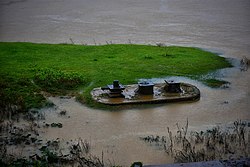
 Varada river at Banavasi Varada river at Banavasi | |
| Location | |
| Country | |
| State | |
| Region | Malenadu |
| Districts | Uttara Kannada Shivamogga Haveri |
| Cities | Banavasi Sagara |
| Physical characteristics | |
| Source | VaradaMoola |
| Mouth | Tungabhadra River |
| • location | Galaganatha |
The Varada River (Verada River) is a river in central Karnataka, India. It originates in Varadamoola . It is a tributary of the Tungabhadra River.
Geography
The Varada river originates near Vardamoola in Sagara of Karnataka. It flows through the Western Ghats and enters the central districts of Karnataka, (Haveri and Bellary). The river joins the Tungabhadra River at Galaganath.
It is important to the wellbeing of the Kannada people along its course. Dams have been constructed along the river's course, providing water for irrigation and domestic purposes during summer. There are, however, no major irrigation projects on this river, although the government is considering one.
Cultural significance
The river has divine association for Indians.
Shringarishi was once in deep penance, praying for forgiveness, from Lord vishnu, for committing the Bramhahatyadosha. Sriman Narayana appeared before him and poured gangajal on the rishi's head. This gangajal formed the Varada river.
Notes
- Varada (Approved) at GEOnet Names Server, United States National Geospatial-Intelligence Agency
- Verada (Variant) at GEOnet Names Server, United States National Geospatial-Intelligence Agency
- Topographic map "Davangere, India, ND-43-07, 1:250,000" Series U502, Army Map Service, November 1958
14°55′47″N 75°40′56″E / 14.92972°N 75.68222°E / 14.92972; 75.68222
Categories: