| Vladičin Han Владичин Хан (Serbian) | |
|---|---|
| Town and municipality | |
      Vladičin Han Vladičin Han | |
 Coat of arms Coat of arms | |
 Location of the municipality of Vladičin Han within Serbia Location of the municipality of Vladičin Han within Serbia | |
| Coordinates: 42°42′N 22°04′E / 42.700°N 22.067°E / 42.700; 22.067 | |
| Country | |
| Region | Southern and Eastern Serbia |
| District | Pčinja |
| Settlements | 51 |
| Government | |
| • Mayor | Goran Mladenović (SNS) |
| Area | |
| • Town | 4.30 km (1.66 sq mi) |
| • Municipality | 366 km (141 sq mi) |
| Elevation | 386 m (1,266 ft) |
| Population | |
| • Town | 7,343 |
| • Town density | 1,700/km (4,400/sq mi) |
| • Municipality | 17,532 |
| • Municipality density | 48/km (120/sq mi) |
| Time zone | UTC+1 (CET) |
| • Summer (DST) | UTC+2 (CEST) |
| Postal code | 17510 |
| Area code | +381(0)17 |
| Car plates | VR |
| Website | www |
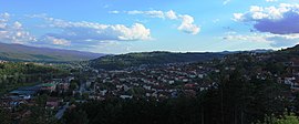
Vladičin Han (Serbian Cyrillic: Владичин Хан, pronounced [ʋlǎdit͡ʃiŋ xâːn]) is a town and municipality located in the Pčinja District of southern Serbia. As of 2022, the population of the town is 7,343, while the population of the municipality is 17,532.
History
From 1929 to 1941, Vladičin Han was part of the Vardar Banovina of the Kingdom of Yugoslavia.
Settlements

Aside from the town of Vladičin Han, the municipality includes the following settlements:
- Balinovce
- Bačvište
- Belanovce
- Beliševo
- Bogoševo
- Brestovo
- Dekutince
- Donje Jabukovo
- Dupljane
- Džep
- Garinje
- Gornje Jabukovo
- Gramađe
- Jagnjilo
- Jastrebac
- Jovac
- Kalimance
- Kacapun
- Koznica
- Kopitarce
- Kostomlatica
- Kržince
- Kukavica
- Kunovo
- Lebet
- Lepenica
- Letovište
- Ljutež
- Mazarać
- Manajle
- Manjak
- Mrtvica
- Ostrovica
- Polom
- Prekodolce
- Priboj
- Ravna Reka
- Rdovo
- Repince
- Repište
- Ružić
- Solačka Sena
- Srneći Dol
- Stubal
- Suva Morava
- Tegovište
- Urvič
- Vrbovo
- Zebince
- Žitorađe
Demographics
| Year | Pop. | ±% p.a. |
|---|---|---|
| 1948 | 24,946 | — |
| 1953 | 25,927 | +0.77% |
| 1961 | 26,074 | +0.07% |
| 1971 | 25,231 | −0.33% |
| 1981 | 25,441 | +0.08% |
| 1991 | 25,225 | −0.09% |
| 2002 | 23,703 | −0.56% |
| 2011 | 20,871 | −1.40% |
| 2022 | 17,532 | −1.57% |
| Source: | ||
According to the 2011 census results, the municipality of Vladičin Han has a population of 20,871 inhabitants.
Ethnic groups
The ethnic composition of the municipality:
| Ethnic group | Population | % |
|---|---|---|
| Serbs | 18,644 | 89.33% |
| Romani | 1,503 | 7.20% |
| Bulgarians | 88 | 0.42% |
| Macedonians | 23 | 0.11% |
| Russians | 10 | 0.05% |
| Others | 603 | 2.89% |
| Total | 20,871 |
Economy
The following table gives a preview of the total number of registered people employed in legal entities per their core activity (as of 2018):
| Activity | Total |
|---|---|
| Agriculture, forestry and fishing | 71 |
| Mining and quarrying | - |
| Manufacturing | 1451 |
| Electricity, gas, steam and air conditioning supply | 221 |
| Water supply; sewerage, waste management and remediation activities | 123 |
| Construction | 276 |
| Wholesale and retail trade, repair of motor vehicles and motorcycles | 394 |
| Transportation and storage | 283 |
| Accommodation and food services | 193 |
| Information and communication | 14 |
| Financial and insurance activities | 18 |
| Real estate activities | - |
| Professional, scientific and technical activities | 89 |
| Administrative and support service activities | 59 |
| Public administration and defense; compulsory social security | 235 |
| Education | 332 |
| Human health and social work activities | 179 |
| Arts, entertainment and recreation | 43 |
| Other service activities | 52 |
| Individual agricultural workers | 9 |
| Total | 3,844 |
Gallery
-
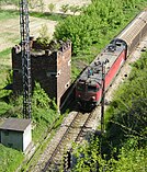
 Vladičin Han railway station
-
 Vrla River
-
 Jovačko Lake
-
 Destroyed highway bridge during the 1999 NATO bombing
See also
References
- "Municipalities of Serbia, 2006". Statistical Office of Serbia. Retrieved 2010-11-28.
- "Census 2022: Total population, by municipalities and cities". popis2022.stat.gov.rs.
- Vladičin / Владичин pronounced in isolation: [ʋlǎdit͡ʃin].
- "2011 Census of Population, Households and Dwellings in the Republic of Serbia" (PDF). stat.gov.rs. Statistical Office of the Republic of Serbia. Retrieved 11 January 2017.
- "Попис становништва, домаћинстава и станова 2011. у Републици Србији" (PDF). stat.gov.rs. Republički zavod za statistiku. Retrieved 15 January 2017.
- "MUNICIPALITIES AND REGIONS OF THE REPUBLIC OF SERBIA, 2019" (PDF). stat.gov.rs. Statistical Office of the Republic of Serbia. 25 December 2019. Retrieved 28 December 2019.
External links
| Capital: Vladičin Han | ||
| Villages |
|  |
| Landmarks | ||
This Pčinja District, Serbia location article is a stub. You can help Misplaced Pages by expanding it. |
