 | |
| Geography | |
|---|---|
| Location | Pacific Ocean |
| Coordinates | 16°33′S 167°47′E / 16.550°S 167.783°E / -16.550; 167.783 |
| Archipelago | Vanuatu, Maskelyne Islands |
| Highest elevation | 9 m (30 ft) |
| Highest point | Mont Siop |
| Administration | |
| Province | Malampa Province |
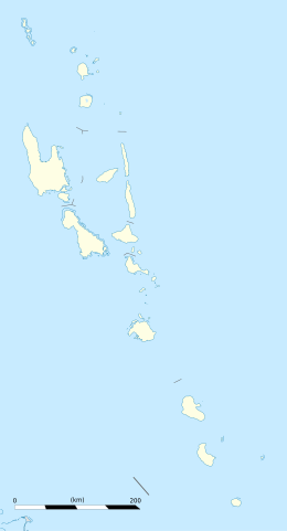
Vulaï (also Île Wulei, Île Woulei) is a small inhabited island in Malampa Province of Vanuatu in the Pacific Ocean. It is a part of the Maskelyne Islands archipelago. The island is also known as Harper Island.
Geography
Vulaï lies off the southeastern coast of Malekula Island, which is the second-largest island in the nation of Vanuatu. The estimated terrain elevation above sea level is 9 metres.
References
- "Traveling Luck for Vulai". Traveling Luck. Retrieved 27 August 2018.
- "Vulai". Geoview. Retrieved 27 August 2018.
- Seech, John. "Vulai Island, Vanuatu". Travel Vanuatu. Retrieved 27 August 2018.
- "Vulai Island". Mapcarta. Retrieved 27 August 2018.
| Islands of Vanuatu by province | |||||||||||||
|---|---|---|---|---|---|---|---|---|---|---|---|---|---|
| Provinces of Vanuatu |  | ||||||||||||
| Islands and islets |
| ||||||||||||
This Vanuatu location article is a stub. You can help Misplaced Pages by expanding it. |