| This article needs additional citations for verification. Please help improve this article by adding citations to reliable sources. Unsourced material may be challenged and removed. Find sources: "Waldbredimus" – news · newspapers · books · scholar · JSTOR (February 2022) (Learn how and when to remove this message) |
| Waldbredimus Waldbriedemes | |
|---|---|
| Commune | |
 | |
 Coat of arms Coat of arms | |
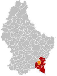
 Map of Luxembourg with Waldbredimus highlighted in orange, and the canton in dark red Map of Luxembourg with Waldbredimus highlighted in orange, and the canton in dark red | |
| Coordinates: 49°33′25″N 6°17′15″E / 49.5569°N 6.2875°E / 49.5569; 6.2875 | |
| Country | |
| Canton | Remich |
| • Rank | 86th of 102 |
| Highest elevation | 359 m (1,178 ft) |
| • Rank | 77th of 102 |
| Lowest elevation | 170 m (560 ft) |
| • Rank | 13th of 102 |
| Population | |
| • Total | 1,337 |
| • Rank | 98th of 102 |
| • Rank | 68th of 102 |
| Time zone | UTC+1 (CET) |
| • Summer (DST) | UTC+2 (CEST) |
| LAU 2 | LU0001208 |
| Website | waldbredimus.lu |
Waldbredimus (Luxembourgish: Waldbriedemes) is a small town and former commune in south-eastern Luxembourg. It is part of the canton of Remich, which is part of the district of Grevenmacher. The commune's administrative centre was Trintange.
Until 31 August 2023, it was a commune. On 1 September 2023, the commune was merged with Bous to form the new commune of Bous-Waldbredimus.
As of 2023, the town of Waldbredimus, which lies in the centre of the former commune, has a population of 602.
Former commune
The former commune consisted of the villages:
- Ersange (Ierseng)
- Roedt (Réid)
- Trintange (Trintingen, Trënteng)
- Waldbredimus (Waldbriedemes)
- Gondel (lieu-dit)
- Gondeler Millen (lieu-dit)
Church
The parish of Waldbredimus dates to the time of Charlemagne. In 1214 Gerhard, the Abbot of Munster, received it in a land swap. Already in the Early Middle Ages (around the 11th/12h centuries), a church existed here in the Romanesque style. Of this original church, only the tower remains. The church was originally dedicated to the Holy Trinity. During the Thirty Years' War, Saint Sebastian became its patron saint, who was seen as a defender against the plague.
Around 1460, the present church was constructed in the Gothic style. It is cruciform, and possesses vaulting ribs supported by representational capitals. Of particular note are the altar of the Three Kings, the gravestones of the lords of Wiltheim and Gondelange, and the keystone bearing the coat of arms of the abbey of Munster.
In spite of frequent damage from fires and storms, the church remained intact throughout the centuries. Plans for an enlargement failed several times. It was not until 1884 that serious restoration work took place, with government subsidies. Amongst other things, the sacristy was connected to the mysterious upper room of the "leprous crusader" through a spiral staircase.
A second, more far-reaching restoration took place from 1964-1967, organised by the Commission des sites et monuments nationaux. During the re-working of the flooring, 24 graves from the time of 1675-1784 were found in the chancel and nave area.
Twin towns – sister cities
Waldbredimus is twinned with:
 Hrušky, Czech Republic
Population
| Graphs are unavailable due to technical issues. Updates on reimplementing the Graph extension, which will be known as the Chart extension, can be found on Phabricator and on MediaWiki.org. |
References
- "Legilux". public.lu. Retrieved 11 October 2023..
- "Registre national des personnes physiques RNPP : Population par localité". data.public.lu. 2024-01-07.
- ^ Luxemburger Wort (1978), p. 6
- "Obec Hrusky" (in French). Waldbredimus. Retrieved 2023-11-12.
- "Population par canton et commune". statistiques.public.lu. Retrieved 11 January 2022.
Further reading
- Gredt, N. (1883). Sagenschatz des Luxemburger Landes (in German). V. Bück. pp. 374, 530.
External links
 Media related to Waldbredimus at Wikimedia Commons
| Places adjacent to Waldbredimus | ||||||||||||||||
|---|---|---|---|---|---|---|---|---|---|---|---|---|---|---|---|---|
| ||||||||||||||||
This article related to the geography of Remich canton is a stub. You can help Misplaced Pages by expanding it. |