Human settlement in England
| Walden Head | |
|---|---|
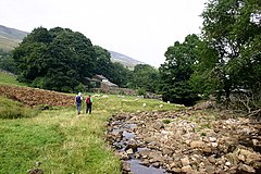
 Approaching Walden Head Approaching Walden Head | |
 | |
| Civil parish | |
| Unitary authority | |
| Ceremonial county | |
| Region | |
| Country | England |
| Sovereign state | United Kingdom |
| Police | North Yorkshire |
| Fire | North Yorkshire |
| Ambulance | Yorkshire |
| 54°13′19″N 2°01′29″W / 54.22202°N 2.02467°W / 54.22202; -2.02467 | |
Walden Head is a hamlet in the Yorkshire Dales, North Yorkshire. It lies 5 miles (8 km) of Aysgarth and to the north is a similar village Walden. The village lies in the civil parish of Burton-cum-Walden.
The hamlet is bisected by Walden Beck which runs for 9 miles (14.3 km) from the watershed on Buckden Pike to Bishopdale Beck just before it flows under the A684 road in the valley. The road from West Burton peters out just south of the hamlet, but an old packhorse track goes over Buckden Pike and ends in the village of Starbotton.
Walden Head, like the other small settlements in the Walden Valley, have changed little over modern times. The Walden Valley is sometimes referred to as Waldendale, but this is not common. The name Walden means 'Valley of the Welsh'.
See also
References
- "OL30" (Map). Yorkshire Dales - Northern & Central Area. 1;25,000. Explorer. Ordnance Survey. 2016. ISBN 9780319263358.
- "Walden Beck from Source to Bishopdale Beck". environment.data.gov.uk. Retrieved 23 October 2017.
- Marsh, Terry (2005). The Dales Way (2 ed.). Milnthorpe, Cumbria: Cicerone. p. 51. ISBN 978-1-85284-464-6.
- ^ Reid, Mark. "Walden & Harland Hill" (PDF). The Northern Echo. Retrieved 23 October 2017.
- "Waldendale, a tributary valley of Wensleydale, North Yorkshire, Yorkshire Dales". www.yorkshire-dales.com. Retrieved 23 October 2017.
External links
![]() Media related to Walden Head at Wikimedia Commons
Media related to Walden Head at Wikimedia Commons
This North Yorkshire location article is a stub. You can help Misplaced Pages by expanding it. |