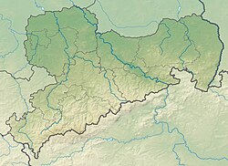
| Wallroda Dam | |
|---|---|
 | |
 | |
| Official name | Talsperre Wallroda |
| Country | Germany |
| Location | Bautzen, Saxony |
| Coordinates | 51°7′4″N 13°58′35″E / 51.11778°N 13.97639°E / 51.11778; 13.97639 |
| Construction began | 1986 |
| Opening date | 1989 |
| Dam and spillways | |
| Height (foundation) | 11.6 metres (38 ft) |
| Height (thalweg) | 10.1 metres (33 ft) |
| Length | 200 metres (660 ft) |
| Elevation at crest | 260.89 metres (855.9 ft) |
| Width (crest) | 3 metres (9.8 ft) |
| Dam volume | 22,000 cubic metres (780,000 cu ft) |
| Reservoir | |
| Total capacity | 840,000 cubic metres (30,000,000 cu ft) |
| Surface area | 36 hectares (89 acres) |
| Normal elevation | 259.7 metres (852 ft) |
| Current water level values (in German) | |
Wallroda Dam (German: Talsperre Wallroda) is a dam near Radeberg, Germany.
Construction
The dam was built between 1986 and 1989 in Wallroda [de] near Radeberg and south of Großröhrsdorf, with the intended purpose of supplying water to farms and fisheries in the area. It also has a small part in regional flood prevention strategies.
Recreational activities

Camping
A campsite can be found on the northern bank of the dam. Additionally, there are a restaurant and a miniature golf course.
Swimming
There are no water rescue facilities, anyone who enters the water does so at their own risk.
Fishing
The dam's reservoir is listed with the Deutscher Anglerverband (German Angling Association). For environmental protection reasons, fishing is only permitted in designated areas.
See also
References
- ^ "Talsperre Wallroda - Infos". www.seen.de (in German). Retrieved 6 July 2020.
- "Gefahrenkarte Große Röder, Los 3.2 - Arnsdorf bei Dresden" (PDF) (in German). Landestalsperrenverwaltung des Freistaates Sachsen. 22 February 2005. p. 6. Retrieved 6 July 2020.
- "Home :: LuxOase". www.luxoase.de. Retrieved 6 July 2020.
- "Gewässerordnung / Gewässerverzeichnis Ausgabe 2018 - 2020" (PDF) (in German). Landesanglerverband Sachsen. p. 58. Retrieved 6 July 2020.