| Wang | |
|---|---|
| Municipality | |
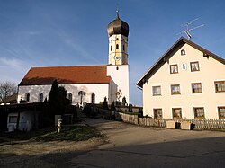
 Church of Saint Martin Church of Saint Martin | |
 Coat of arms Coat of arms | |
Location of Wang within Freising district
 | |
  | |
| Coordinates: 48°30′N 11°57′E / 48.500°N 11.950°E / 48.500; 11.950 | |
| Country | Germany |
| State | Bavaria |
| Admin. region | Oberbayern |
| District | Freising |
| Municipal assoc. | Mauern |
| Government | |
| • Mayor (2020–26) | Markus Stöber |
| Area | |
| • Total | 31.19 km (12.04 sq mi) |
| Elevation | 415 m (1,362 ft) |
| Population | |
| • Total | 2,551 |
| • Density | 82/km (210/sq mi) |
| Time zone | UTC+01:00 (CET) |
| • Summer (DST) | UTC+02:00 (CEST) |
| Postal codes | 85368 |
| Dialling codes | 08761 / 08764 |
| Vehicle registration | FS |
| Website | www.wang-obb.de |
Wang is a municipality in the district of Freising in Bavaria in Germany.
Archaeology
Wang is home to a large Neolithic archaeological site with up to six phases of occupation. It was first excavated by Jens Lüning (de) in the 1980s where several intercutting periods came to pass. It is also one of the most southerly eras of the first Linear Pottery culture (LBK) horizon period when sedimentary ideas, although not necessarily new people, came to central Europe. Most famous for the longhouse, this area uncovered several belonging to the LBK.
The site was recently reopened by A.W.R Whittle and D. Hoffman in 2008, 50 meters south of the original excavation where another three longhouses were fully excavated and 3 more uncovered.
References
- Liste der ersten Bürgermeister/Oberbürgermeister in kreisangehörigen Gemeinden, Bayerisches Landesamt für Statistik, 15 July 2021.
- Genesis Online-Datenbank des Bayerischen Landesamtes für Statistik Tabelle 12411-003r Fortschreibung des Bevölkerungsstandes: Gemeinden, Stichtag (Einwohnerzahlen auf Grundlage des Zensus 2011).
| Towns and municipalities in Freising (district) | ||
|---|---|---|
This Freising district location article is a stub. You can help Misplaced Pages by expanding it. |
